GPS Drones Are Lying About Their Accuracy
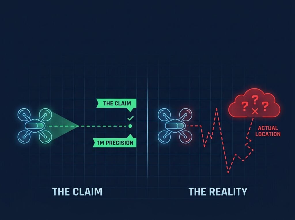
Every drone spec sheet has a line about positioning accuracy, something like “plus or minus 0.1 meter vertical, plus or minus 0.3 meter horizontal.” It reads precise. It reads trustworthy. And for a lot of real-world jobs, it’s quietly misleading, because that number was measured under ideal conditions your actual survey site will probably never hand you.
This isn’t a story about DJI or any one manufacturer cutting corners. Every consumer and prosumer GPS works this way. The real problem is what “GPS accuracy” actually means once you unpack it, and why so many surveyors, mappers, and construction firms across India have learned this the expensive way, usually right after a client rejects a deliverable for being off by a meter or more.
Why standard GPS drifts more than the spec sheet suggests
Standard GPS, even GPS combined with GLONASS or other constellations, relies on signals travelling from satellites roughly 20,000 kilometers away. On that journey the signal passes through the ionosphere and troposphere, both of which bend and delay it in ways that shift with weather, time of day, and solar activity. The receiver estimates a correction for this, but it’s an estimate, not a measurement, and that built-in uncertainty is where most of the error hides.
Then there’s multipath interference, which gets a lot worse in exactly the environments where drone mapping tends to matter most: dense urban blocks, construction sites boxed in by tall structures, mining pits with steep walls. Signals bounce off buildings, cranes, and rock faces before reaching the receiver, arriving late and confusing the position calculation.
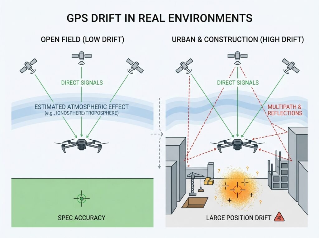
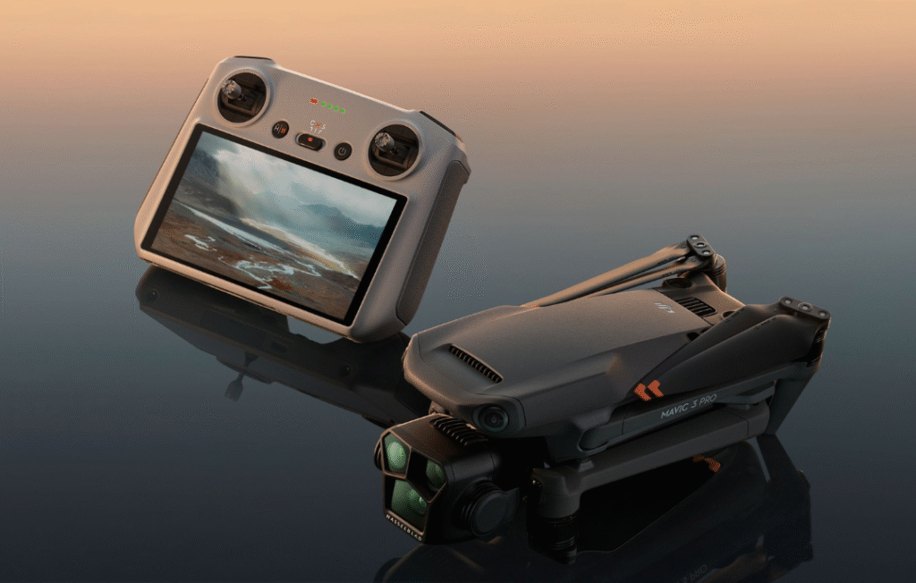
A drone flying an open field, a standard Mavic 3 Pro say, might genuinely land close to its rated accuracy. Fly the same drone between two buildings on an urban infrastructure job and it can be off by several meters with zero warning, because the flight app has no idea the signal got compromised.
Standard accuracy figures are also usually quoted as CEP50, which means the stated number is only guaranteed for half the readings. The other half of the time, the actual error is worse than what’s printed. Nobody scrolling a spec page notices that detail, which is exactly why two identical flights over the same site can produce two noticeably different results.
Where this actually costs people money
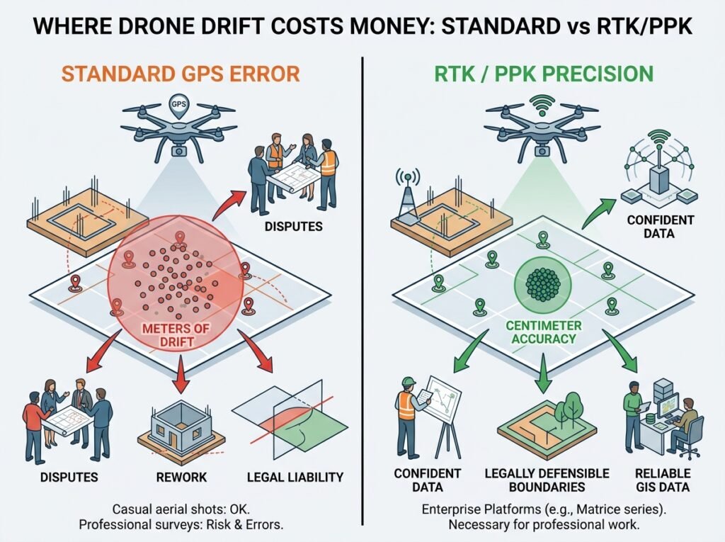
For casual aerial photography, none of this matters much. A couple of meters of drift on a scenic shot changes nothing. It shows up hard in professional survey and mapping work though, where deliverables get checked against ground control points and legal boundaries. A construction progress report built on GPS-only data can misrepresent volumes and elevations enough to trigger a dispute with a contractor. A land survey used for boundary documentation can be legally indefensible if it can’t be tied to a known reference accuracy. Utility and infrastructure mapping that feeds into a GIS system compounds small drone errors across every asset logged, turning a tiny per-point error into a dataset-wide problem.
This is exactly why RTK and PPK exist, and why serious enterprise platforms increasingly ship with them built in rather than bolted on as an accessory. Machines like the Matrice 350 RTK and the newer Matrice 4 series carry RTK as standard, not optional. Real Time Kinematic positioning uses a base station, either a physical unit set up on site or a network correction service, to send live correction signals to the drone mid-flight. Instead of estimating atmospheric delay, the system measures the actual difference between the base station’s known position and the satellite signals it’s receiving, then applies that exact correction in real time. The result lands in centimeter territory, typically 1 to 2 centimeters horizontally and 2 to 3 vertically, a different category entirely from standard GPS.
Post Processed Kinematic, or PPK, does something similar but corrects the data after the flight instead of during it, which makes it more resilient on sites where a live correction signal might drop mid-mission, handy for remote survey areas without reliable connectivity.
How to actually know which one you need
Not every project needs RTK precision, and buying it when you don’t is its own kind of waste. The honest way to decide is to ask what happens if the deliverable is off by a meter. For aerial photography, real estate marketing, or general inspection footage, the answer is nothing meaningful happens, and a standard GPS drone like the Air 3S is genuinely fine. For land surveying, construction staking, mining volumetrics, cadastral mapping, or anything feeding into legal, financial, or engineering decisions, a meter of error stops being a rounding issue and starts being a liability. This is where a Matrice 4 RTK paired with a Zenmuse L2 LiDAR payload earns its price tag, since the LiDAR point cloud is only as trustworthy as the position data underneath it.
Site environment matters just as much as the deliverable. Even a project that would tolerate standard GPS accuracy in open terrain might still need RTK simply because the site is boxed in by structures guaranteeing multipath interference. Urban infrastructure work, tunnel and bridge inspections, and dense industrial sites almost always benefit from RTK regardless of tolerance, because the alternative is re-flying the whole mission once the first dataset turns out unusable.
The bigger issue is that most buyers never learn any of this until a client rejects a report or a boundary dispute lands on their desk. Drone marketing leans hard on accuracy numbers because they sound impressive, without ever explaining the conditions those numbers depend on. Anyone selling survey-grade equipment should be walking a buyer through this distinction before the sale, not after a failed project forces the conversation.
If your work involves anything that gets measured, verified, or defended later, don’t take the spec sheet’s accuracy figure at face value. Ask what positioning system the drone actually uses, whether RTK or PPK comes built in or needs an add-on module, and what accuracy the manufacturer guarantees under real, not ideal, conditions. At Dronevex, that conversation happens before the invoice, not after, whether the fit turns out to be a Matrice 350 RTK for a mining survey or something lighter for a site that never needed centimeter accuracy to begin with. That single conversation is usually the difference between a drone that pays for itself and one that quietly generates rework nobody budgeted for.