DJI Dock 4 and Matrice 5TD for Emergency Response: Faster Aerial Overviews
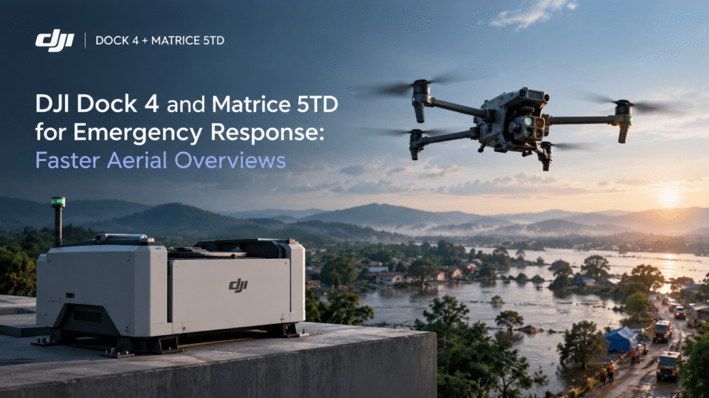
When an incident unfolds, the first few minutes are about information. Where is the problem, how big is it, and is it safe to approach? Responders often have to answer those questions from the ground, with limited visibility. An aerial view can change that, and the DJI Dock 4 and Matrice 5TD are designed to make that view easier to get. DJI launched the two together in October 2026.
Why an Aerial Overview Matters
Before personnel approach a scene, they need context. Smoke, darkness, uneven terrain, damaged structures and restricted access all slow down a ground assessment. A drone can give teams a quick look at the incident area, helping them decide where to send people and what to prepare for. That is the real value: better situational awareness, sooner.
What the DJI Matrice 5TD Brings to an Incident
The DJI Matrice 5TD is an enterprise drone built for inspection, monitoring and situational awareness. Several of its capabilities suit emergency work.
Thermal imaging
The thermal camera has a stated native resolution of 1280 × 1024, with an Ultra High Resolution mode advertised at up to 2560 × 2048. Thermal imaging shows temperature differences, so it can help teams locate heat sources and areas of interest that are hard to see in ordinary footage.
Night vision
Incidents do not wait for daylight. The Matrice 5TD supports full-colour night vision, with a stated 4K capability, plus an auxiliary near-infrared light for black-and-white imaging. Visibility still depends on available light, distance, weather and camera mode.
Telephoto imaging
The 11× telephoto capability lets operators observe distant subjects without flying close to them. That helps when a scene is unstable or when keeping the aircraft away from hazards matters.
Laser ranging
The integrated laser rangefinder measures distances up to 3,000 metres under specified conditions. It helps teams estimate distance to a selected object and obtain location information, which can support search-and-rescue coordination and preliminary wildfire monitoring. Reflectivity, visibility and measurement conditions affect the real range, so treat the figure as a ceiling.
Obstacle sensing and flight time
The drone combines a rotating LiDAR sensor, three-directional millimetre-wave radar and six-directional vision sensing, with wire-level sensing advertised for thin obstacles. DJI specifies up to 59 minutes of maximum flight time under controlled test conditions, though wind, temperature, payload and battery condition will change that on the day. Operators must still assess hazards and follow safe flight procedures.
What the DJI Dock 4 Adds
A drone is only useful once it is in the air. The DJI Dock 4 houses the Matrice 5TD between flights and supports remote deployment, so a mission can launch without someone standing beside the aircraft. DJI states the dock can complete a battery swap in about 25 seconds, which helps the drone return to the air quickly.
For emergency response, that can matter in two ways. A drone already positioned at or near a site can be dispatched remotely when an alert comes in. And quick battery swaps support repeated flights when an incident needs ongoing observation.
This depends on the right setup: suitable connectivity, mission planning and compliance with applicable rules. Remote operations still need proper oversight, and the time saved will depend on how your site and procedures are arranged.
Where the Combination Can Help
Search and rescue. Thermal imaging, night vision and laser ranging can help teams cover large or difficult areas and identify points of interest for ground teams to check. Search plans and personnel remain in charge.
Fire and heat-source assessment. Thermal imagery can help show where heat is concentrated, giving teams a preliminary picture from a distance. It is not a substitute for fire service judgement and assessment on the ground.
Industrial incidents. Large plants and industrial sites can use a docked drone to check an alert area before sending staff in, and thermal imaging can help spot unusual heat around equipment.
Infrastructure and utility events. Telephoto and thermal imaging can help teams examine electrical infrastructure and other assets from a safe distance. Findings still need review by qualified engineers, who decide what the imagery means.
What a Drone Cannot Do
Be realistic about the limits. A drone supplies images and data; people make the decisions. Thermal imagery shows temperature differences, not causes, and a clear view from above does not mean the ground is safe. Weather, smoke, darkness and distance all affect what the cameras can show.
Treat every figure in this guide as manufacturer-stated and subject to conditions. The drone should complement your established emergency procedures, not replace them.
What to Plan Before You Buy
Emergency use raises the bar for preparation. Before requesting a quotation, think through:
- Scenarios: Which incidents you want to support, and what information responders need first.
- Site and dock placement: Where the dock would sit, plus power and connectivity needs. Confirm technical requirements with DJI’s documentation and your supplier.
- People and training: Who plans missions, monitors flights and interprets thermal imagery, and how they are trained.
- Procedures: How drone footage feeds into your existing command and communication processes.
- Regulations: Indian import, registration, airspace and operating requirements, including any conditions on remote or emergency operations, confirmed before purchase and deployment.
- Cost: Availability, configuration, accessories, service arrangements and whether you need the dock.
Enquire About the DJI Dock 4 and Matrice 5TD in India
Planning for emergency response with the DJI Dock 4 and Matrice 5TD? Contact Dronevex for configuration guidance, pricing and availability at contact@dronevex.in or call +91 9429694828 / 9071136060. Our team will help you understand your requirements and find the right setup for your application.
Frequently Asked Questions
Can the DJI Matrice 5TD be used for emergency response?
It can support scene assessment, search-and-rescue coordination and preliminary wildfire monitoring, using thermal imaging, night vision, telephoto imaging and laser ranging. It complements established response procedures rather than replacing them.
Does the DJI Dock 4 make response faster?
The dock supports remote deployment, and DJI states it can swap a battery in about 25 seconds. Real-world speed depends on your setup, connectivity, planning and applicable rules.
Can the DJI Matrice 5TD see at night?
Yes. It supports full-colour night vision and near-infrared illumination for black-and-white imaging, though performance depends on operating conditions.
How long can the DJI Matrice 5TD fly?
DJI specifies up to 59 minutes under controlled test conditions. Real-world flight time varies with wind, temperature, payload and battery condition.
Is the DJI Matrice 5TD compatible with DJI Dock 4?
Yes. DJI introduced the two together so the drone can be used in docked, automated workflows. Confirm the exact configuration with your supplier.
What is the price of the DJI Dock 4 and Matrice 5TD in India?
Pricing varies with configuration, accessories and availability. Contact Dronevex for a quotation.