
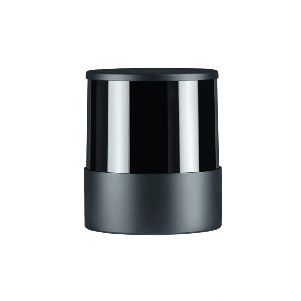
Unitree 3D LiDAR 16 Channels
The 3D LiDAR – 16 Channels is a high-performance 3D laser sensor designed for Go1 Edu, AlienGo, and B1 robotic platforms. It captures detailed three-dimensional point cloud data to help robots understand their surroundings and perform intelligent navigation tasks.
After installation, the sensor supports map construction, autonomous positioning, navigation planning, and dynamic obstacle avoidance, allowing compatible robots to move more efficiently in changing environments. These functions improve environmental perception and support autonomous robot operation.
The system includes the complete source code for the LiDAR navigation program, giving developers the flexibility to study, modify, and build custom applications based on their own project requirements. Some supporting documentation is currently provided in Chinese.
The 3D LiDAR – 16 Channels is suitable for robotics research, AI development, autonomous navigation, education, and indoor or outdoor robotic applications that require reliable 3D environmental sensing.
Key Features
16-Channel 3D Point Cloud
Generates dense three-dimensional environmental data for robotic perception.
Autonomous Navigation Support
Provides data for map construction, positioning, navigation planning, and obstacle avoidance.
Open-Source Development
Includes the complete LiDAR navigation source code for customization and secondary development.
Environmental Perception
Helps robots detect surrounding objects and navigate through dynamic environments.
Compatible Unitree Platforms
Designed for Go1 Edu, AlienGo, and B1 robots.
Technical Specifications
| Feature | Specification |
|---|---|
| Product Model | 3D LiDAR – 16 Channels |
| Product Type | 3D LiDAR Sensor |
| Compatible Robots | Go1 Edu, AlienGo, B1 |
| Point Cloud | 16-Channel 3D Point Cloud |
| Navigation Functions | Map Construction, Autonomous Positioning, Navigation Planning, Dynamic Obstacle Avoidance |
| Development Support | Open-Source LiDAR Navigation Program |
| Source Code | Included |
| Documentation | Some Documents Available in Chinese |
FAQs
Which robots are compatible with this LiDAR?
It is designed for Go1 Edu, AlienGo, and B1 robotic platforms.
What functions does the LiDAR provide?
It supports map construction, autonomous positioning, navigation planning, and dynamic obstacle avoidance.
Does it generate 3D point cloud data?
Yes. It provides 16-channel 3D point cloud data for environmental perception.
Is the navigation source code included?
Yes. The complete LiDAR navigation source code is included for development and customization.
Is all documentation available in English?
No. Some documentation is currently provided in Chinese.
What applications is this sensor suitable for?
It is suitable for robotics research, AI development, autonomous navigation, education, and robotic perception projects.

Reviews
There are no reviews yet.