Precision Aerial Intelligence

DRONE
SURVEY
& MAPPING

Turn aerial imagery into accurate maps, 3D models and measurable data. Dronevex delivers professional drone surveying and mapping for infrastructure, construction, mining, roads and large-scale projects.
CM+
Precision Data
3D
Terrain Models
GIS
Ready Data
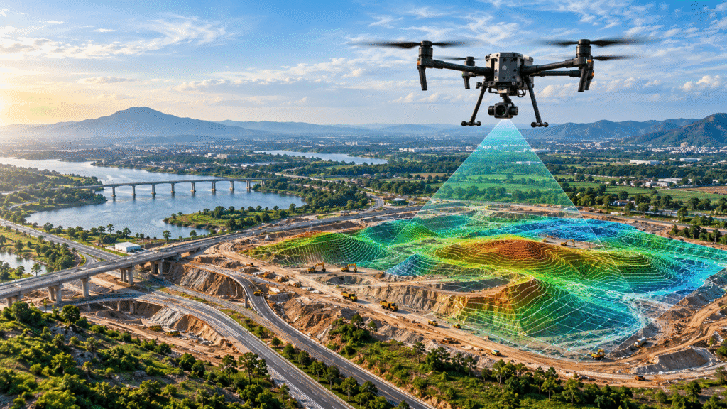
Drone Survey and Mapping
LAT 20.2961° N
LNG 85.8245° E
ALT 142.6 M
ACC ± 2.4 CM
Survey Status
● LIVE
Aerial data acquisition
Mapping Output
2,847 HA
Area mapped
DRONEVEX / GEOSPATIAL SYSTEM
SCROLL TO EXPLORE
WHAT HAPPENS AFTER TAKEOFF

FROM DRONE FLIGHT
TO PROJECT DATA.

We don't just capture aerial photographs. Dronevex converts high-resolution drone imagery into accurate maps, 3D models, measurements and geospatial information that your project team can actually use.

Drone Survey and Mapping
AERIAL SURVEY / LIVE
HIGH-RESOLUTION DATA CAPTURE
ORTHOMOSAIC
3D MODEL
GIS DATA
DATA COVERAGE
LARGE AREA

One flight. Multiple layers of information.

Our survey workflow transforms raw aerial imagery into structured project data — from the first flight to the final engineering-ready deliverables.

01
CAPTURE
High-resolution aerial imagery collected across your project area.
02
PROCESS
Survey imagery is processed into accurate geospatial datasets.
03
BUILD
Generate orthomosaics, 3D models, point clouds and terrain information.
04
MEASURE
Extract area, elevation, distance, volume and other project measurements.
✓
READY FOR YOUR PROJECT Accurate aerial data • GIS-ready outputs • Actionable project insights
SURVEY OUTPUTS

DATA THAT
WORKS FOR YOU.

From raw aerial imagery to engineering-ready outputs, your survey becomes a collection of accurate digital assets that can be measured, analysed and used across your project.

OUTPUT / 01
◫
Orthomosaic Maps
High-resolution, geometrically corrected aerial maps for accurate visualisation and site analysis.
OUTPUT / 02
◈
3D Terrain Models
Detailed 3D representations of terrain and project sites for planning and visualisation.
OUTPUT / 03
⠿
Point Clouds
Dense spatial datasets that capture detailed surface and terrain information.
SURVEY DATASET
MULTI-LAYER GEOSPATIAL OUTPUT
SYSTEM
● READY
OUTPUT / 04
≋
DEM / DSM
Elevation and surface models that help understand terrain, levels and site conditions.
OUTPUT / 05
◎
Contour Maps
Elevation contours that make terrain variation easier to understand and analyse.
OUTPUT / 06
△
Area & Volume
Accurate measurements for quantities, planning, earthwork and project progress tracking.
THE SURVEY PROCESS

FROM BRIEF
TO DELIVERABLE.

Every project follows a structured workflow designed to turn your requirements into accurate aerial data and usable survey outputs.

SURVEY MISSION / WORKFLOW ACTIVE
✦
01
◌
DEFINE
Understand the project
We start by understanding your site, objectives, required accuracy and the data your project team needs.
  • Project requirements
  • Survey area
  • Required outputs
01
02
◇
PLAN
Build the flight mission
Our team plans the aerial mission, flight paths and data-capture strategy around your site conditions.
  • Flight planning
  • Coverage strategy
  • Site assessment
02
03
✦
FLY
Capture aerial data
Professional drones capture detailed aerial imagery across the defined survey area.
  • High-resolution imagery
  • Survey coverage
  • Ground data capture
03
04
◈
PROCESS
Turn imagery into data
Raw imagery is processed into structured geospatial information and survey deliverables.
  • Image processing
  • 3D reconstruction
  • Geospatial datasets
04
05
✓
DELIVER
Ready for your team
Receive accurate maps, models, measurements and project-ready survey outputs.
  • Maps & models
  • Measurements
  • Project insights
05
WHERE IT CREATES VALUE

BUILT FOR
COMPLEX PROJECTS.

From construction sites and infrastructure corridors to land development and mining, aerial surveying provides a faster way to understand large and complex environments.

Drone Survey Project
PROJECT / AERIAL 07
MULTI-INDUSTRY SURVEY
SYSTEM ● ACTIVE
SITE A / 01
ZONE B / 02
SURVEY / 03
LAT 20.2961° N
LNG 85.8245° E
ALT 142.6 M
PROJECT COVERAGE
LARGE AREA
01
Construction
Site mapping, progress tracking, measurements and documentation.
→
◈
02
Roads & Infrastructure
Corridor mapping, terrain analysis and infrastructure documentation.
→
╱
03
Mining & Quarry
Stockpile measurement, volumetric analysis and terrain mapping.
→
△
04
Land Development
Existing-condition surveys, elevation data and development planning.
→
◎
05
Real Estate
Large-site documentation, aerial mapping and project visualisation.
→
◫
06
Agriculture & Land
Large-area mapping, terrain analysis and aerial site intelligence.
→
✦
ONE PLATFORM. MULTIPLE PROJECT APPLICATIONS.
DISCUSS YOUR PROJECT →
THE TECHNOLOGY

PRECISION IS
BUILT IN.

Professional drone surveying combines high-resolution aerial capture, positioning technology and advanced processing to turn raw imagery into accurate geospatial data.

TECHNOLOGY / 01
◉
Photogrammetry
Capture overlapping aerial imagery and reconstruct detailed 2D and 3D representations of the survey area.
TECHNOLOGY / 02
⊕
RTK / PPK
Positioning workflows can improve the geographic accuracy of captured survey data.
TECHNOLOGY / 03
◈
3D Reconstruction
Convert aerial imagery into point clouds, terrain models and detailed 3D project environments.
TECHNOLOGY / 04
◎
GIS & Data
Transform survey information into structured geospatial datasets for analysis and project workflows.
DIGITAL TERRAIN MODEL
AERIAL DATA → SPATIAL INTELLIGENCE
PROJECT VALUE

WHAT THIS
CHANGES FOR
YOUR PROJECT.

Drone surveying is more than aerial photography. It gives your project team a detailed view of the site — helping you capture, measure, compare and understand large areas with data that can be used throughout the project lifecycle.

Drone Survey and Mapping
AERIAL DATA CAPTURE
LAT 28°36'42.2"N
LON 77°12'18.5"E
SITE COVERAGE / ACTIVE
01 / COVERAGE
◇

Faster Site Coverage

Capture large and complex project areas efficiently through planned aerial survey missions.

02 / FIELDWORK
+

Less Repetitive Fieldwork

Use aerial datasets to reduce repetitive measurements and improve visibility across difficult or extensive sites.

03 / DATA
◌

More Than Images

Generate maps, 3D models, point clouds, elevation data and measurable project information.

04 / COMPARISON
↗

Track Project Change

Repeat aerial surveys can help teams compare site conditions and document project progress over time.

05 / ACCESS
◎

Understand Difficult Areas

Capture visual and spatial information from large, elevated or difficult-to-access project environments.

Shopping Cart

Product Enquiry

Scroll to Top