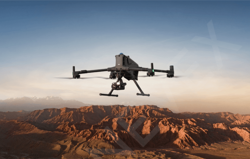
What Makes the DJI Zenmuse L3 Special?
A great map tells a story. A great LiDAR map tells the truth.
The DJI Zenmuse L3 LiDAR Sensor is built for professionals who rely on precision, performance, and reliability whether it’s surveying vast land areas, inspecting critical infrastructure, monitoring forests, or planning projects that demand highly accurate 3D data.
This isn’t just another drone accessory, it’s a potent sensor that converts drone flights into trustworthy information for making decisions.
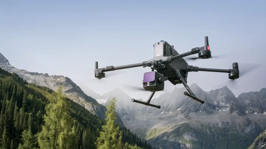
The Zenmuse L3 delivers reliable data and expedited workflows by fusing cutting edge LiDAR technology with industry standard imaging to capture accurate measurements and detailed images in a single flight.
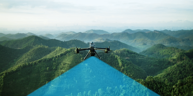
Long Range LiDAR for Wider Coverage
The L3 features powerful LiDAR scanning that can detect terrain and objects up to 950 meters away, even on less reflective surfaces. As a result, operators can gather precise data from higher altitudes without sacrificing detail and cover more ground in a single flight. This allows faster mapping with greater operational efficiency. This capability is especially valuable for large scale projects where efficiency, coverage, and consistent data quality are critical across expansive or challenging terrain.
High Resolution RGB Cameras
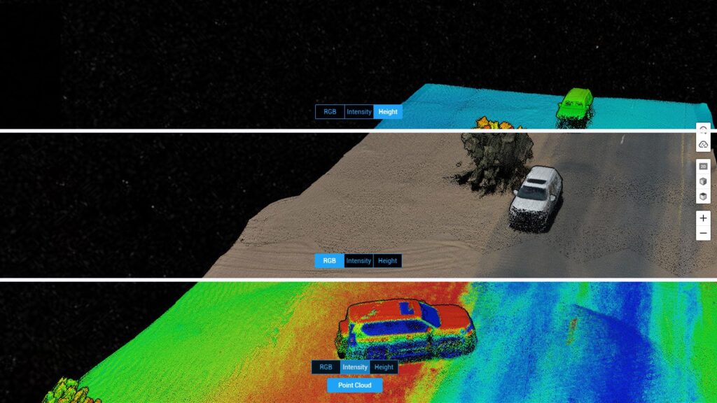
The DJI Zenmuse L3 integrates dual 100 megapixel RGB cameras that capture rich, high detail visuals alongside LiDAR data. These cameras add true to life color and texture to 3D maps, making terrain, structures, and features easier to interpret during mapping, modeling, and analysis. This results in clearer visuals and more confident decision making. By combining visual clarity with spatial accuracy, professionals can better analyze site conditions and communicate results more effectively.
Centimeter Level Accuracy
Accuracy matters. For topographic mapping, engineering surveys, construction planning, and other professional applications, the Zenmuse L3’s centimeter level data precision makes it dependable. This level of accuracy helps professionals make confident, data driven decisions while reducing measurement errors, saving time and cost during project execution. This reliability is crucial for projects where even small measurement errors can impact safety, cost, or long-term outcomes.

Up to 16 Returns per Pulse
Instead of capturing only one distance point, the L3 collects multiple returns per laser pulse. This allows it to “see through” vegetation and capture ground surfaces underneath a big advantage for forestry and terrain mapping. This ensures more complete and accurate data, even in dense or complex environments. It enables a more complete understanding of complex landscapes, improving accuracy in environments where traditional methods often fall short.
Who Is the Zenmuse L3 For?
This isn’t just a cool gadget, it’s a serious surveying tool for:
✔ Land surveyors and geospatial professionals
✔ Civil engineers & construction teams
✔ Forestry and environmental analysts
✔ Mining operations & stockpile monitoring
✔ Infrastructure and utility inspection teams
✔ Urban planners and development projects
If your work depends on precise land or structure data, the Zenmuse L3 does the heavy lifting from the sky.
Top Use Cases — Real Impact, Real Results
Land Surveying & Topographic Mapping
Beyond traditional ground surveys. The L3 maps vast regions in a matter of hours, whereas manual data collection used to take days.
Forestry & Vegetation Analysis
Even with tree cover, capture the fine details of the terrain surfaces. Recognize vegetation patterns, canopy heights, and the shape of the terrain quickly and accurately.
Infrastructure & Inspection Projects
The L3 offers accurate 3D models and visuals of everything from bridges to towers, powerlines to highways, assisting teams in the safe and effective planning, evaluation, and management of assets.
Mining & Earthworks Monitoring
In operations where accuracy is crucial, you can save time and lower risks by confidently monitoring stockpile volumes, terrain changes, and ground movements.
Why DJI Zenmuse L3 Is a Game Changer
Faster Data Less Field Time
Instead of manual surveying that takes days, a single drone flight can capture high-resolution LiDAR and imagery data in just one session.
Better Insight – More Confidence
When you build a 3D model from both LiDAR and RGB data, your decisions are based on both shape and sight. That’s powerful.
Safer Workflows
No climbing, no risky access points, and no waiting for ground crews. The sensor does the job from the air, keeping your team safer.
Conclusion
The DJI Zenmuse L3 LiDAR Sensor represents a new standard in professional aerial mapping and data capture, bringing together long range LiDAR performance, high resolution RGB imaging, multi-return scanning, and centimeter level accuracy in a single, enterprise ready solution. Designed for surveying, infrastructure inspection, forestry analysis, and large-scale terrain mapping, it empowers professionals to collect reliable, high quality data with speed and confidence.
By integrating advanced sensing technology with intelligent data capture capabilities, the Zenmuse L3 streamlines complex workflows and reduces the limitations of traditional ground based methods. Its ability to deliver accurate, detailed insights even in challenging environments allows teams to make informed decisions, optimize project timelines, and improve overall operational efficiency.
Supported by DJI’s robust engineering standards and Dronevex’s expert guidance and after sales support, the Zenmuse L3 is built for long-term reliability and demanding professional use. For organizations and professionals seeking precision, scalability, and clarity in aerial mapping, the DJI Zenmuse L3 offers a powerful, future ready solution that elevates data collection beyond conventional boundaries.
FAQ's
What is the DJI Zenmuse L3 used for?
The Zenmuse L3 is used for aerial LiDAR mapping, topographic surveys, forestry analysis, mining monitoring, and infrastructure inspection.
Does Zenmuse L3 capture images?
Yes. It pairs LiDAR data with high resolution imagery using dual 100MP cameras.
How far can the Zenmuse L3 scan?
It can detect objects and surfaces up to approximately 950 meters away under optimal conditions.
Is it suitable for dense vegetation areas?
Yes. The multiple returns per LiDAR pulse help penetrate vegetation to capture ground surface details.
What accuracy can I expect?
The L3 delivers centimeter level accuracy, suitable for professional surveying and engineering tasks.
Can the Zenmuse L3 be used for construction planning?
Absolutely, accurate 3D data supports design, planning, monitoring, and analysis for construction teams.
What drone platforms is it compatible with?
The Zenmuse L3 is designed to integrate with DJI enterprise series drones like the Matrice series.
Why choose LiDAR over photogrammetry alone?
LiDAR captures distance measurements directly and can capture through vegetation, while photogrammetry only generates 3D models from visual overlap. Combining both gives richer data.
Does using the L3 reduce field survey time?
Yes. Large scale mapping that once took days on the ground can be done in a few hours from the air.
Where can I buy the DJI Zenmuse L3 in India?
You can explore and purchase the DJI Zenmuse L3 at Dronevex, with support and guidance for professional use.