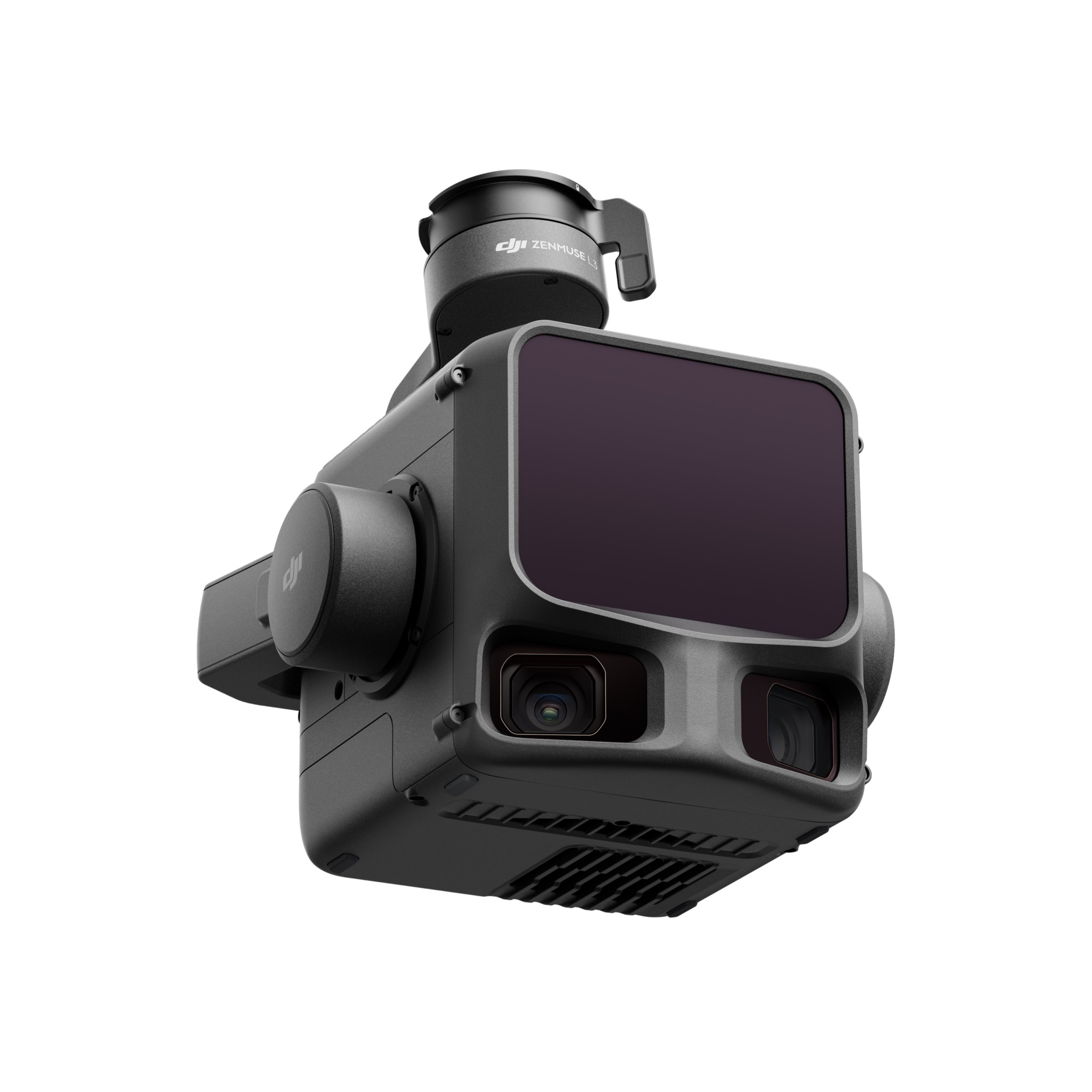
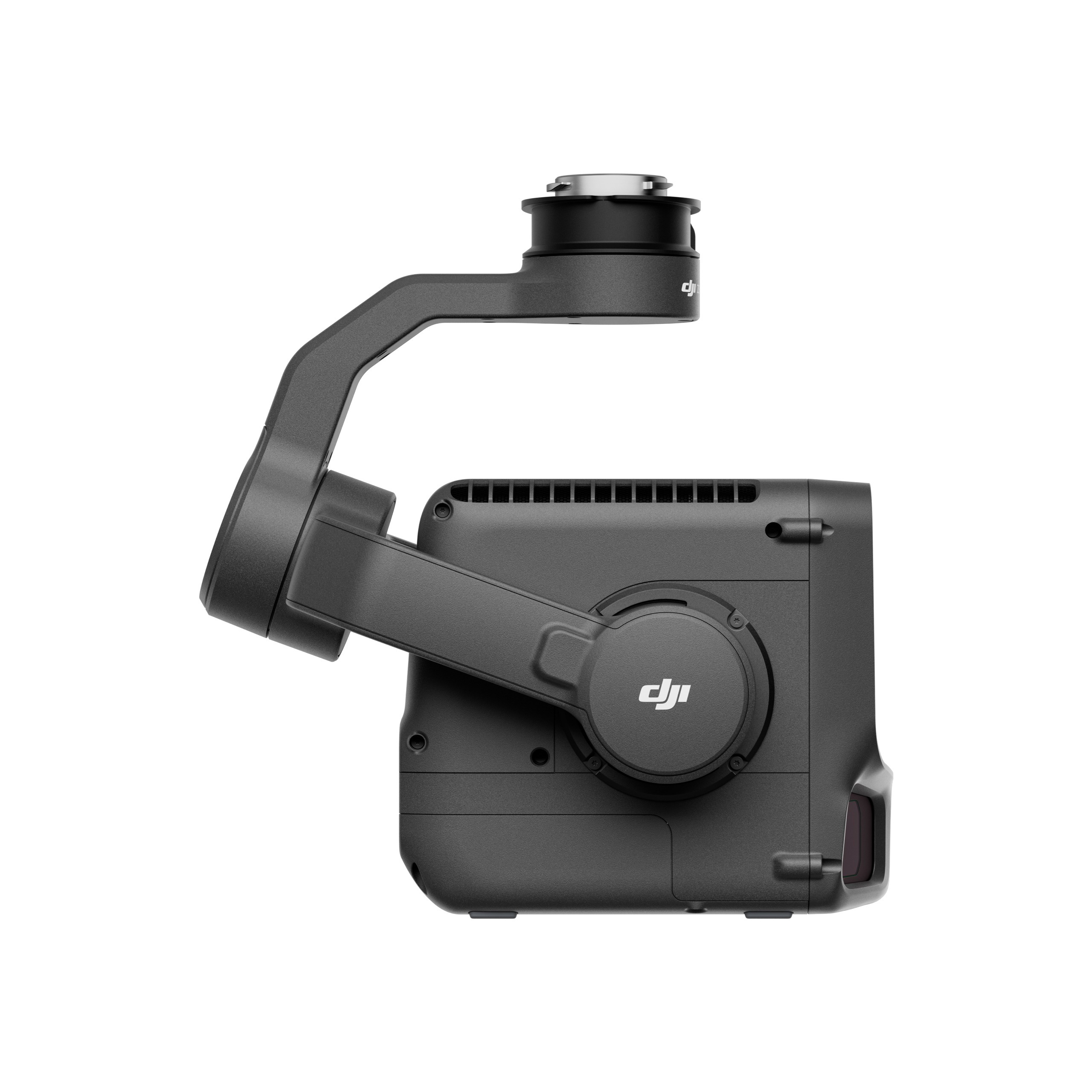
DJI Zenmuse L3
Introducing Zenmuse L3— DJI’s next-generation high-accuracy aerial LiDAR system designed for demanding enterprise and industrial missions. With a long-range 1535 nm LiDAR that can reach up to 950 m even on objects with just 10 % reflectivity, combined with dual 100 MP RGB mapping cameras and a high-precision POS system, this payload is engineered to accelerate large-scale geospatial data collection and deliver rich, accurate data sets for surveying, inspection, infrastructure and public-safety use.
More than simply “better range,” the L3 also brings enhancements in point-cloud quality (up to 16 returns), wider field-of-view in its imaging system, improved gimbal and POS stability, and a streamlined workflow for processing. Whether it’s large-area terrain mapping, inspection of tall transmission towers, or complex vegetation and built-environment scanning, the L3 aims to deliver “see through, far and true” performance.
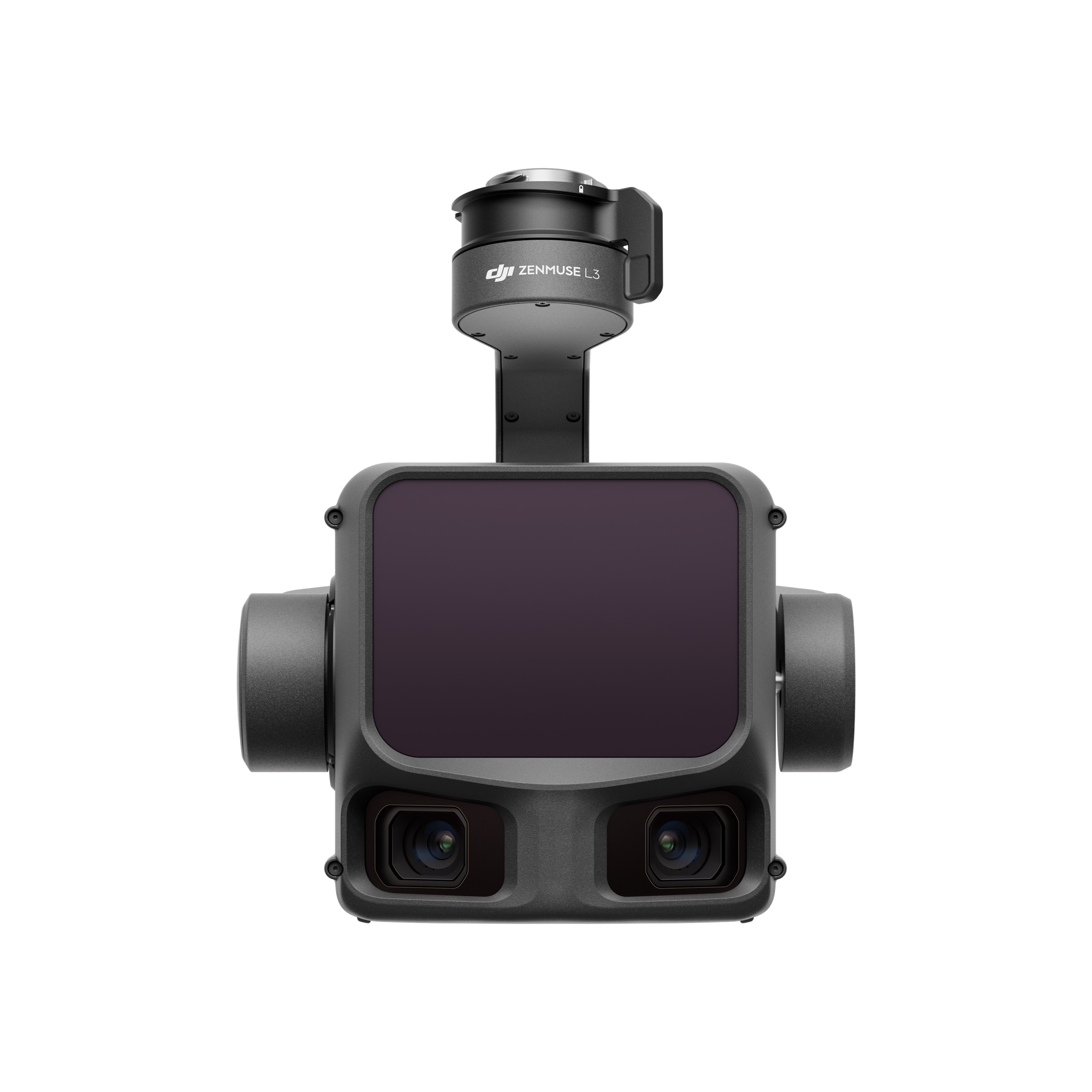
Dual 100MP RGB Mapping Camera System
High Accuracy
Upto 100 km² Per Day
High Penetration
Dual 100MP RGB Mapping Camera System
The DJI Zenmuse L3 features an advanced dual 100-megapixel RGB mapping camera setup, engineered for professional-grade aerial imaging. With ultra-high resolution and expanded field of view, it captures rich, detailed visuals that perfectly complement LiDAR data. This dual-camera design ensures crisp textures, accurate color representation, and superior photogrammetry output — enabling creation of highly realistic 3D models and true-to-life digital twin environments. Whether mapping urban landscapes, documenting infrastructure, or surveying large-scale terrain, the L3 delivers unmatched clarity and consistency in every frame.
High Accuracy
Designed for precision-critical missions, the DJI Zenmuse L3 delivers exceptional measurement accuracy down to the centimeter level. Powered by an advanced positioning and orientation system (POS) and high-stability gimbal, it achieves reliable and repeatable results even in challenging environments. Surveyors, engineers, and GIS professionals can confidently depend on the L3 for accurate contours, elevation models, and structural data — reducing ground control requirements and improving project efficiency. Every scan translates into data you can trust, ensuring compliance with demanding industry standards.
Up to 100 km² Per Day
Engineered for high-efficiency mapping, DJI Zenmuse L3 enables coverage of up to 100 square kilometers per day under optimal conditions. This staggering productivity drastically cuts mission time for large-area projects such as corridor mapping, agricultural studies, forestry surveys, and regional planning. Fewer flights, wider scan coverage, and intelligent mission planning tools streamline field operations — accelerating data delivery and lowering operational costs. From vast open terrains to complex industrial zones, the Zenmuse L3 makes large-scale aerial data collection faster and more practical than ever.
High Penetration
With a powerful 1535nm laser and up to 16-return capability, the DJI Zenmuse L3 excels in penetrating dense vegetation and layered environments. Whether capturing ground elevation beneath forest canopies, mapping foliage-covered slopes, or scanning built-up urban zones, the L3 reveals details that traditional sensors struggle to detect. This deep-penetration performance ensures accurate terrain reconstruction and vegetation analysis, making the L3 ideal for forestry, environmental monitoring, land-resource planning, and advanced ecological studies. Even under thick canopy, critical ground-level data remains visible and measurable.
Hardware Performance Redefined
DJI Zenmuse L3 combines a powerful 1535nm long-range LiDAR sensor, dual 100MP RGB mapping cameras, an advanced high-precision POS system, and a stabilized three-axis gimbal in a compact, lightweight design. This integrated system delivers exceptional data accuracy, superior imaging clarity, and industry-leading efficiency, making it an ideal all-in-one payload for demanding aerial surveying and 3D mapping applications.
Long Range, Wide Coverage
The DJI Zenmuse L3 is equipped with a powerful 1535 nm long-range LiDAR system, capable of detecting objects at distances of up to 950 meters, even on surfaces with just 10% reflectivity under optimal conditions. This impressive range enables operators to fly at higher altitudes and still capture dense, accurate point-cloud data across expansive areas.
Beyond distance, the system’s smaller laser spot size and high single-pulse energy enhance detail capture and improve LiDAR penetration through dense vegetation, complex terrain, and partially obstructed environments
Small Spot, High Energy
With an exceptionally low 0.25 mrad (1/e²) laser beam divergence, DJI Zenmuse L3 produces a much tighter laser spot — roughly one-fifth the size of the Zenmuse L2 at equivalent range. This dramatically improved beam precision enhances the ability to detect and define small, narrow, or distant targets.
The increased energy density of each laser pulse not only improves detail capture but also delivers superior penetration through dense foliage and layered terrain.
High Pulse Rate, Multiple Returns
With a maximum pulse emission rate of 2 million pulses per second and support for up to 16 returns, DJI Zenmuse L3 delivers exceptionally detailed and reliable spatial reconstruction. This high pulse frequency ensures dense, precise point-cloud capture even at faster flight speeds or higher altitudes, while the multi-return capability allows the system to record multiple layers within a single beam path.
Users can adjust point-cloud density and penetration strength based on mission requirements, enabling optimal performance across varied scenarios — whether conducting high-accuracy topographic surveys, mapping dense forests and rugged terrain, or capturing detailed data.
Supports Linear, Star-Shaped, and Non-Repetitive scanning modes for different operational scenarios:
- Linear: Achieves more consistent point cloud distribution, ideal for high-accuracy terrain mapping.
- Star-Shaped: Balances accuracy with multiple scan angles and penetration capability, well-suited for forests or dense urban environments.
- Non-Repetitive: Provides multiple scan angles and broader coverage, optimized for power line inspections and other complex structural surveys.
End-To-End Solution
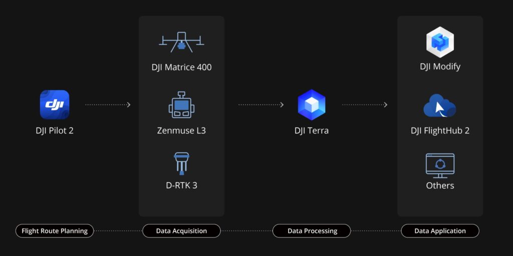
DJI Zenmuse L3 seamlessly integrates with DJI’s ecosystem to deliver an end-to-end mapping solution. From data acquisition and processing to application, this unified workflow is simpler to operate and easier to master than traditional multi-platform setups, helping users efficiently complete a wide range of mapping tasks.
Data Aqusition
Data Processing
DJI Terra features robust built-in PPK (Post-Processed Kinematic) capabilities, compatible with D-RTK 3 and standard base station data.
This capability broadens the application scope of LiDAR across diverse mapping scenarios and delivers higher-quality 3D model outputs.
DJI Terra enables deep integration of LiDAR and RGB data. With a single acquisition, users can simultaneously generate high-accuracy point clouds, 2D maps, and 3D mesh models. This data fusion approach significantly enhances model completeness and detail, especially in environments with complex structures.
Data Application
DJI Modify supports intelligent semantic classification of point clouds, automatically distinguishing ground, vegetation, buildings, wires, electric towers, and more.
DJI Modify’s Profile tool allows users to flexibly select cross-sectional areas of point cloud models for intuitive analysis of terrain variation, structural features, and elevation profiles.
When paired with DJI Modify, Zenmuse L3 delivers versatile outputs. DJI Modify automatically generates a wide range of mapping products from point cloud data
Features
| Feature | Description |
|---|---|
| Long-Range 1535 nm LiDAR | Detects targets up to 950 m even with 10% reflectivity, enabling high-altitude and large-area scanning. |
| Dual 100 MP RGB Cameras | Two 100-megapixel mapping cameras provide ultra-high-resolution imagery and wide FOV for photorealistic mapping and textured 3D models. |
| High-Precision POS System | Advanced GNSS/IMU positioning ensures centimeter-level accuracy with reduced need for GCPs. |
| Up to 2 Million Pulses per Second | High-frequency LiDAR firing enables rich, dense point-cloud data and faster coverage. |
| Up to 16 Returns | Captures multiple surface layers per pulse for vegetation penetration and detailed ground modeling. |
| Ultra-Low Beam Divergence (0.25 mrad) | Tighter laser spot improves detection of thin structures like power lines and branches. |
| High Penetration Capability | Improved energy efficiency delivers dense ground points under trees and vegetation canopies. |
| 100 km² Coverage per Day | Efficient flight planning and long-range scanning enable rapid large-area mapping missions. |
| Three-Axis Stabilized Gimbal | Stable data capture with minimized motion distortion for cleaner point clouds. |
| Multiple Scan Patterns | Supports linear, non-repetitive, and star-pattern scanning for versatility across terrains and industrial scenarios. |
| Compact & Lightweight Payload | Streamlined design optimized for enterprise drones without compromising performance. |
| Seamless DJI Ecosystem Integration | Works with Matrice 400, DJI Pilot 2, and DJI Terra for end-to-end survey workflows. |
FAQ's
What aircraft is the DJI Zenmuse L3 compatible with?
DJI Zenmuse L3 is designed for the DJI Matrice 400 series (M400). Some accessory connectors and platform integration may limit compatibility with other drones.
What accuracy can the L3 achieve?
In DJI’s internal lab tests: better than 3 cm vertical accuracy at 120 m altitude; better than 5 cm at 300 m altitude; better than 10 cm at 500 m.
How far can the L3 capture LiDAR data?
DJI Zenmuse L3 has maximum detection range is up to ~950 m (on objects with ~10% reflectivity) under ideal conditions. Practical altitudes for surveying lie in the 300–500 m range in many cases.
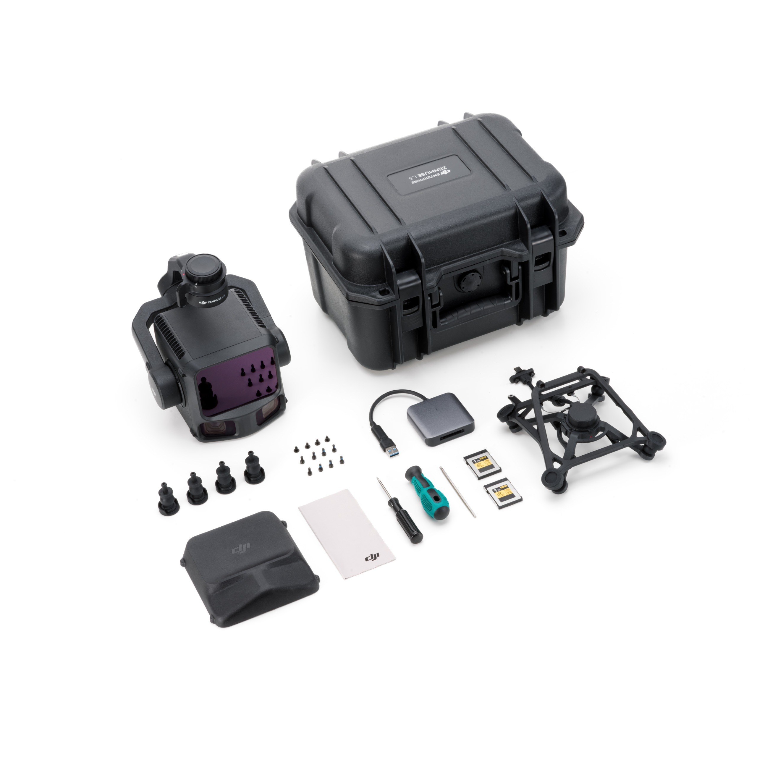
What type of memory card is required?
DJI recommends using the bundled CFexpress Type B (1 TB) card, optimized for the large data output (points, images, calibration files). Using non-bundled / non-certified cards may result in reduced performance or warnings.
What scanning modes does DJI Zenmuse L3 support?
DJI Zenmuse L3 supports Linear, Star-Shaped, and Non-Repetitive scanning modes—each suited for different terrain or object types (flat terrain, forests, complex structures).
How many returns per laser pulse does it support?
DJI Zenmuse L3 has up to 16 returns, enabling more layers of data (e.g., canopy, sub-canopy, ground) especially useful in vegetation or complex built environments.
Is the DJI Zenmuse L3 suitable for dense vegetation mapping?
Yes—for example, thanks to the multiple-return capability and optimized LiDAR, DJI Zenmuse L3 supports vegetation-penetrating workflows. The star-shaped or non-repetitive scanning modes further enhance performance in such environments
What is the typical flight altitude for surveying tasks?
While capable of high altitudes, many workflows recommend 300 m altitude (or similar) for optimal fidelity and efficiency. Some sources indicate 300–500 m altitudes for typical large-area mapping.
Can the L3’s live point-cloud data be streamed in real-time?
Yes—real-time point-cloud data preview is supported (for example through OSDK/PSDK and DJI’s ecosystem). However, this real-time data is for preview; full high-accuracy reconstruction is done offline with software like DJI Terra.
How does the L3 compare to the earlier Zenmuse L2?
Compared to the L2, the DJI Zenmuse L3 offers significantly greater range (up to ~950 m vs ~450 m), more returns per pulse (16 vs 5), dual 100 MP cameras (vs single or lower resolution), and broader FOV in its cameras (≈107° vs ~73°), making it better suited for large-scale, high-efficiency missions.
Explore Our Drone Fleet
Explore Our Full Range of Advanced Drone Solutions


Reviews
There are no reviews yet.