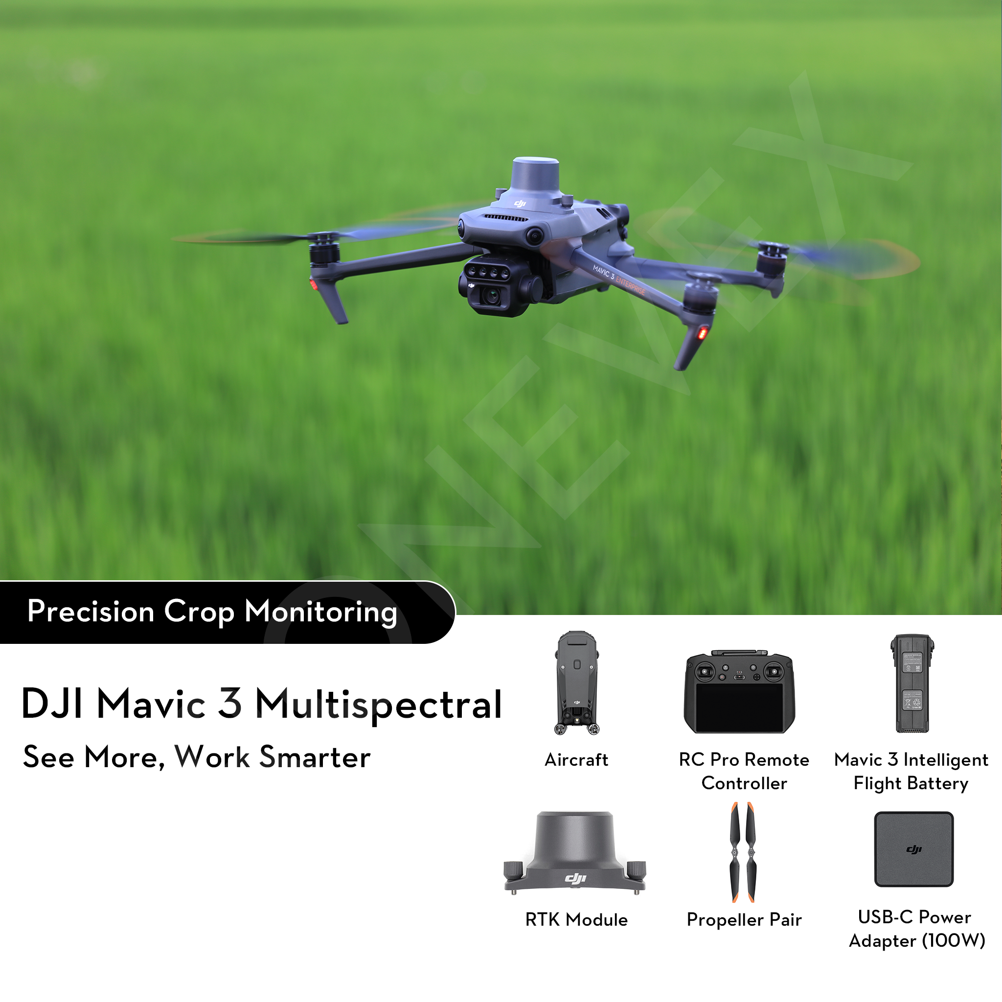
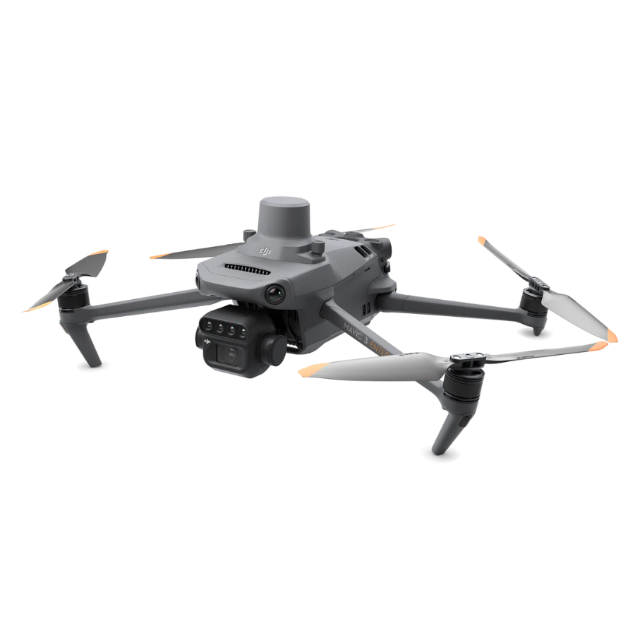
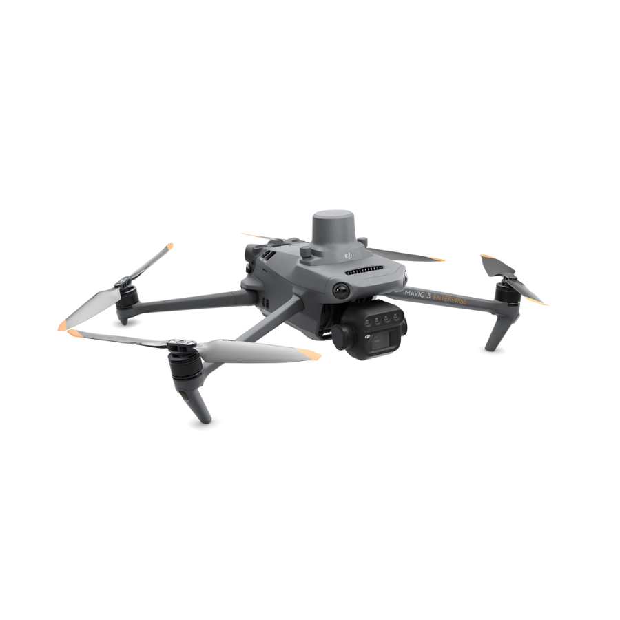
DJI Mavic 3 Multispectral Drone
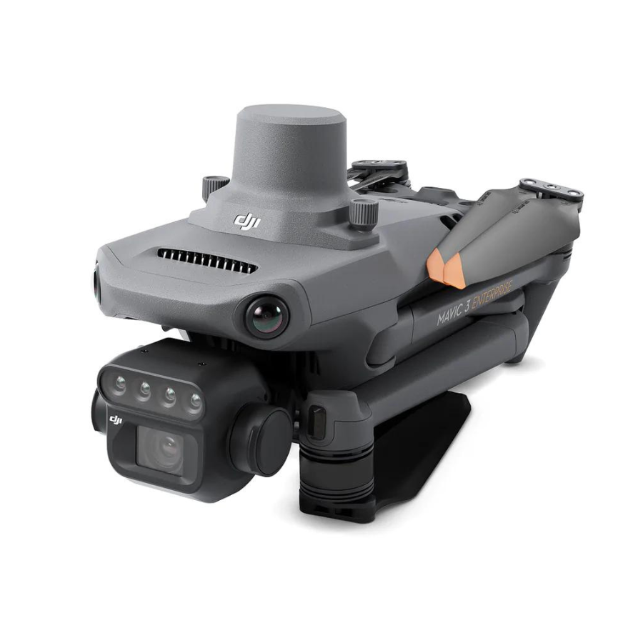
The DJI Mavic 3 Multispectral Drone (Mavic 3M) redefines precision agriculture by combining a powerful 20MP 4/3-inch RGB camera with an integrated multispectral imaging system, offering G (Green), R (Red), Red-Edge (RE), and NIR (Near-Infrared) bands—each at 5MP—for comprehensive crop health monitoring and field analysis. Its foldable, portable design makes it easy to deploy, while its dual-camera capability ensures both photogrammetric accuracy and vegetation insights in a single flight.
Equipped with an RTK module that syncs at microsecond level with both cameras and the flight controller, the DJI Mavic 3 Multispectral Drone delivers centimeter-level geo-tagging, eliminating the need for ground control points in most mapping missions. Combined with a built-in sunlight (incident light) sensor—used to calibrate imagery based on real-time solar irradiance—it ensures consistent NDVI, GNDVI, and NDRE measurements over long-term operations and varying light conditions.
Dual Imaging in One Flight
The all-in-one RGB plus multispectral sensor system allows simultaneous capture of visual and vegetation-specific data—no payload swaps required.
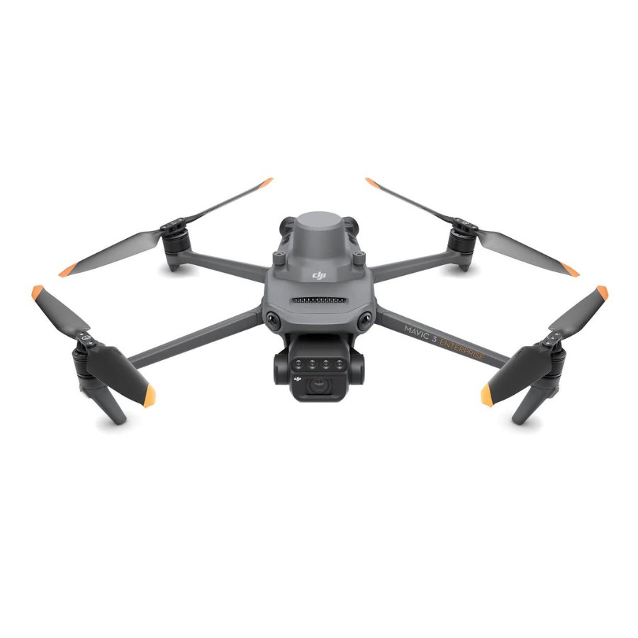
Ultra-Portable, Farm-Ready Form
DJI Mavic 3 Multispectral Drone is truly field-friendly, this drone folds compactly for easy transport, yet delivers robust aerial mapping capabilities.
Optimized for Surveys & Mapping
With a fast shutter (mechanical) and high-resolution capture, the Mavic 3M supports efficient orthomosaic creation and precision mapping.
Long-Range, Reliable Transmission
Its advanced O3 system ensures stable control and HD image streaming up to 15 km—vital for large fields.
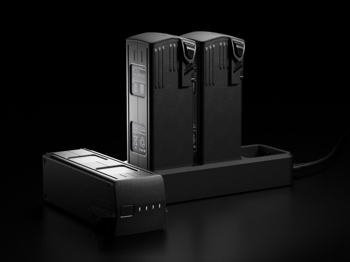
Extended Flight Endurance
Each battery provides up to 43 minutes of flight time, allowing coverage of up to 200 hectares in a single mission.
Efficient Charging Options
Supports fast charging via 100W charging hub or 88W direct charging, minimizing downtime between flights.
Smart Power Management
Intelligent Battery Management System (BMS) ensures safe charging, balanced power distribution, and extended battery life.
Hot-Swappable Design
Batteries can be quickly swapped in the field, enabling continuous operations without long interruptions.
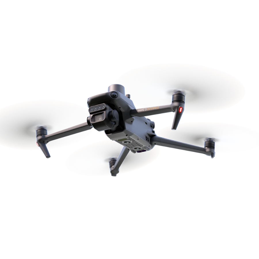
Omnidirectional Obstacle Sensing
The DJI Mavic 3 Multispectral Drone supports omnidirectional obstacle sensing and terrain-following capabilities—ideal for low-altitude flight over orchards or hilly landscapes. Its lightweight, foldable design and DJI’s enterprise ecosystem compatibility (like DJI Terra and SmartFarm Web) further streamline workflows from mission planning to crop prescription mapping.
Operational efficiency is a standout feature: with up to 43 minutes of flight time per battery, the Mavic 3M can survey up to 200 hectares (around 2 km²) in a single mission. Fast-charging via a 100W hub or 88W charger reduces downtime and maximizes productivity. DJI Mavic 3 Multispectral Drone O3 Enterprise transmission system delivers stable, long-range (up to 15 km) video feeds, ensuring seamless live monitoring and data relay.
Features
| Feature | Description |
|---|---|
| RGB + Multispectral Cameras | 20 MP 4/3 RGB + four 5 MP bands (G, R, RE, NIR) for combined visual and plant-health data. |
| Sunlight Sensor | Captures solar irradiance for accurate NDVI calibration across varying light conditions. |
| RTK Positioning | Centimeter-level geo accuracy; synchronized at microsecond speed—minimizes need for GCP. |
| Extended Flight Time | Up to 43 minutes per battery; covers up to ~200 hectares per flight. |
| O3 Transmission | Stable HD video/control up to 15 km range. |
| Obstacle Sensing & Terrain Follow | Omnidirectional obstacle avoidance and safe low-altitude flight modes. |
| Portable Design | Compact, foldable, and lightweight—field-ready and travel-friendly. |
| Software Ecosystem | Integrates with DJI Terra and SmartFarm Web for mapping and prescription maps. |
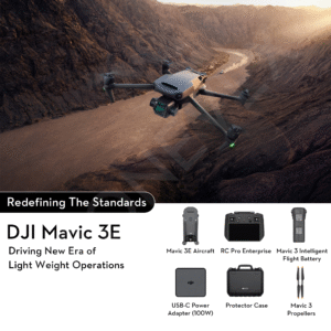
In The Box

Specifications
Specifications
General Specifications
| Feature | Specification |
|---|---|
| Takeoff Weight | Approx. 951 g |
| Dimensions (Folded) | 212 × 96.3 × 90.3 mm (L×W×H) |
| Dimensions (Unfolded) | 347.5 × 283 × 139.6 mm (L×W×H) |
| GNSS | GPS + GLONASS + BeiDou + Galileo |
| Internal Storage | None (microSD required) |
| Protection Rating | IP54 (sensors only) |
Flight Performance
| Feature | Specification |
|---|---|
| Max Ascent Speed | 6 m/s |
| Max Descent Speed | 6 m/s |
| Max Horizontal Speed | 15 m/s |
| Max Flight Time | Up to 43 mins |
| Max Wind Resistance | 12 m/s |
| Max Transmission Range | 15 km (FCC) |
Operating Conditions
| Feature | Specification |
|---|---|
| Operating Temperature | 0°C to 40°C |
Camera & Imaging
| Feature | Specification |
|---|---|
| RGB Camera | 4/3″ CMOS, 20 MP, Mechanical Shutter |
| Multispectral Cameras | 4× 5 MP (G, R, RE, NIR), Global Shutter |
| Multispectral Resolution | 1280 × 1024 per channel |
| Sunlight Sensor | Integrated, real-time radiometric correction |
| Focal Length (Multispectral) | 5.7 mm (FOV: 61.2°) |
Photography & Video
| Feature | Specification |
|---|---|
| Photo Formats | JPEG, DNG (RGB); TIFF (multispectral) |
| Video Resolutions | RGB only: up to 5.1K @ 50fps |
| Multispectral Video | Not supported |
| Shutter Type | Mechanical (RGB), Global (Multispectral) |
Stabilization & Sensing
| Feature | Specification |
|---|---|
| Gimbal | 3-axis (tilt, roll, pan) |
| Obstacle Sensing | Omnidirectional Vision + Infrared |
Connectivity
| Feature | Specification |
|---|---|
| Transmission System | OcuSync 3.0 Enterprise |
| Controller | DJI RC Pro Enterprise (Built-in screen) |
| RTK Module | Supports Real-Time Kinematic positioning |
Battery & Charging
| Feature | Specification |
|---|---|
| Battery Model | DJI Mavic 3 Intelligent Flight Battery |
| Capacity | 5000 mAh, 77 Wh |
| Charging Hub | DJI 100W or 65W USB-C Hub |
| Charging Time | Approx. 60–90 minutes (depending on charger) |
FAQs
What is the DJI Mavic 3 Multispectral used for in agriculture?
The DJI Mavic 3 Multispectral Drone is designed to help farmers and agronomists monitor crop health, optimize yields, and make informed decisions. It captures both RGB and multispectral data, making it perfect for precision agriculture applications like crop scouting, vegetation analysis, and irrigation planning.
What makes this drone different from the regular DJI Mavic 3?
Unlike the standard version, the DJI Mavic 3 Multispectral Drone has a built-in multispectral camera system (including Green, Red, Red Edge, and Near Infrared bands) alongside a regular RGB camera. This allows it to collect data invisible to the human eye—critical for evaluating plant health.
How can farmers benefit from multispectral imaging?
DJI Mavic 3 Multispectral Drone imaging helps detect crop stress, pests, and disease early. With accurate NDVI and other vegetation indices, farmers can take targeted action, reduce waste, and improve productivity.
What is the flight time of the Mavic 3 Multispectral?
DJI Mavic 3 Multispectral Drone offers a flight time of up to 43 minutes, which allows for efficient coverage of large farmland areas in a single session.
Can DJI Mavic 3 Multispectral Drone work with agricultural software platforms?
Yes, it integrates seamlessly with DJI Terra and DJI SmartFarm, as well as other third-party precision ag software for mapping, analysis, and reporting.
How accurate is the data captured by this drone?
It supports RTK (Real-Time Kinematic) positioning, enabling centimeter-level accuracy, which is essential for high-precision field mapping and analysis.
Is the Mavic 3 Multispectral easy to use for non-technical users?
Absolutely. DJI Mavic 3 Multispectral Drone iscompact, quick to deploy, and comes with intuitive mission planning software. Even users new to drone tech can fly pre-set routes and collect valuable data with ease.
Can it be used for crop spraying or just data collection?
The Mavic 3 Multispectral is designed specifically for data collection, not spraying. However, it can guide spraying drones more efficiently by identifying problem areas in the field.
What is the transmission range of this drone?
It features OcuSync 3.0 transmission with a range of up to 15 km (FCC), ensuring stable, real-time image and data transmission even across large farmlands.
Is it safe to fly in varying weather conditions?
While DJI Mavic 3 Multispectral Drone is durable and reliable, it’s best to avoid flying in heavy rain or strong winds. For optimal results, fly under clear weather to ensure accurate data capture.
Explore Our Drone Fleet
Explore Our Full Range of Advanced Drone Solutions


Reviews
There are no reviews yet.