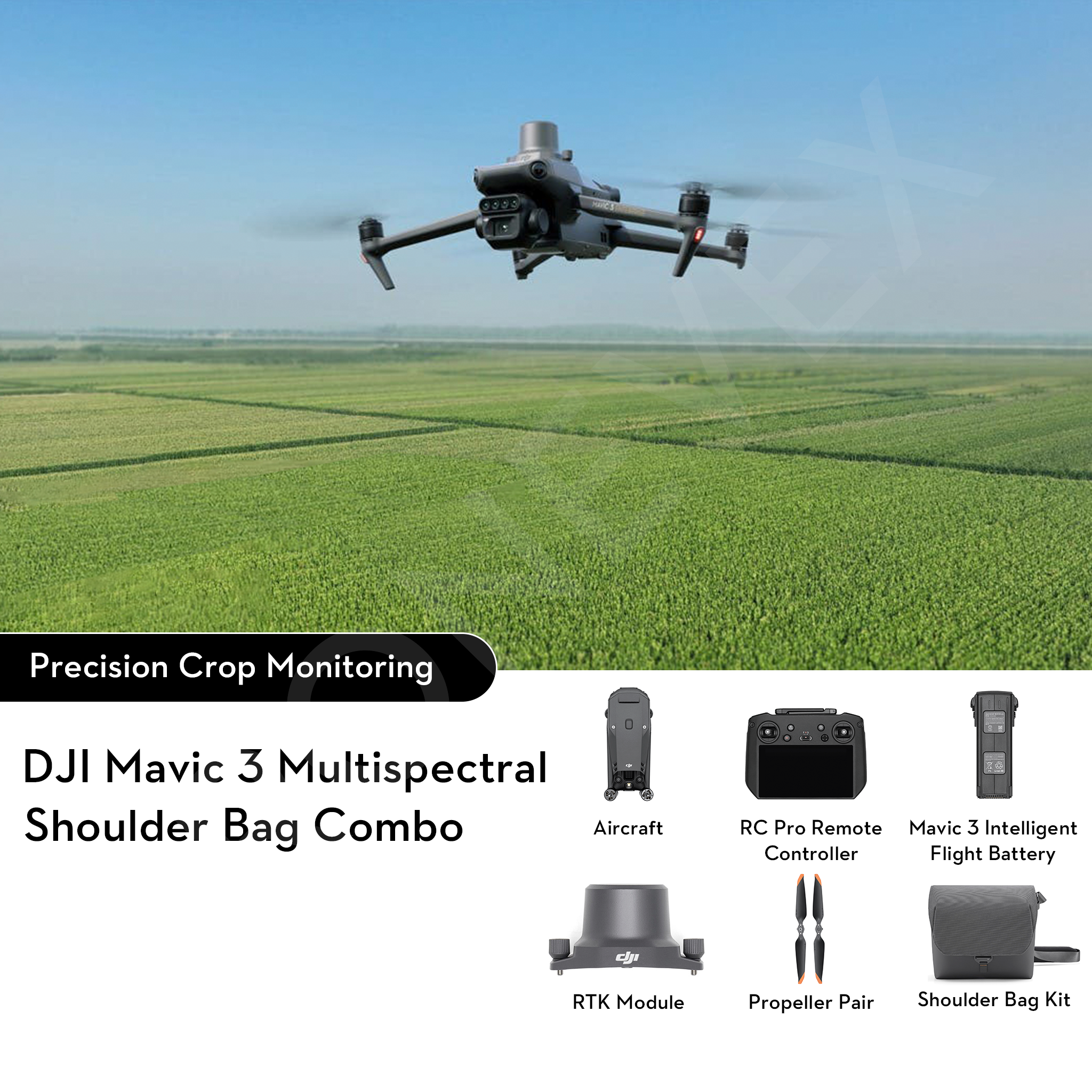
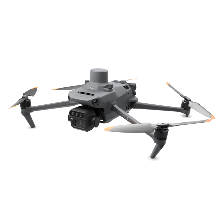
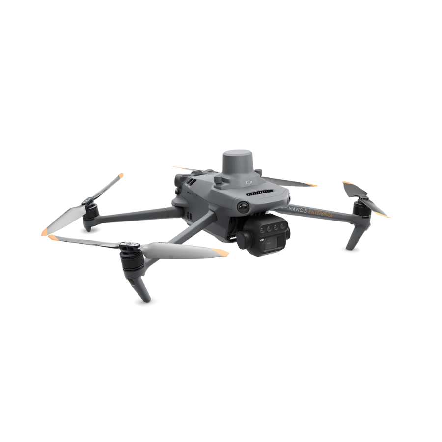
DJI Mavic 3 Multispectral Drone
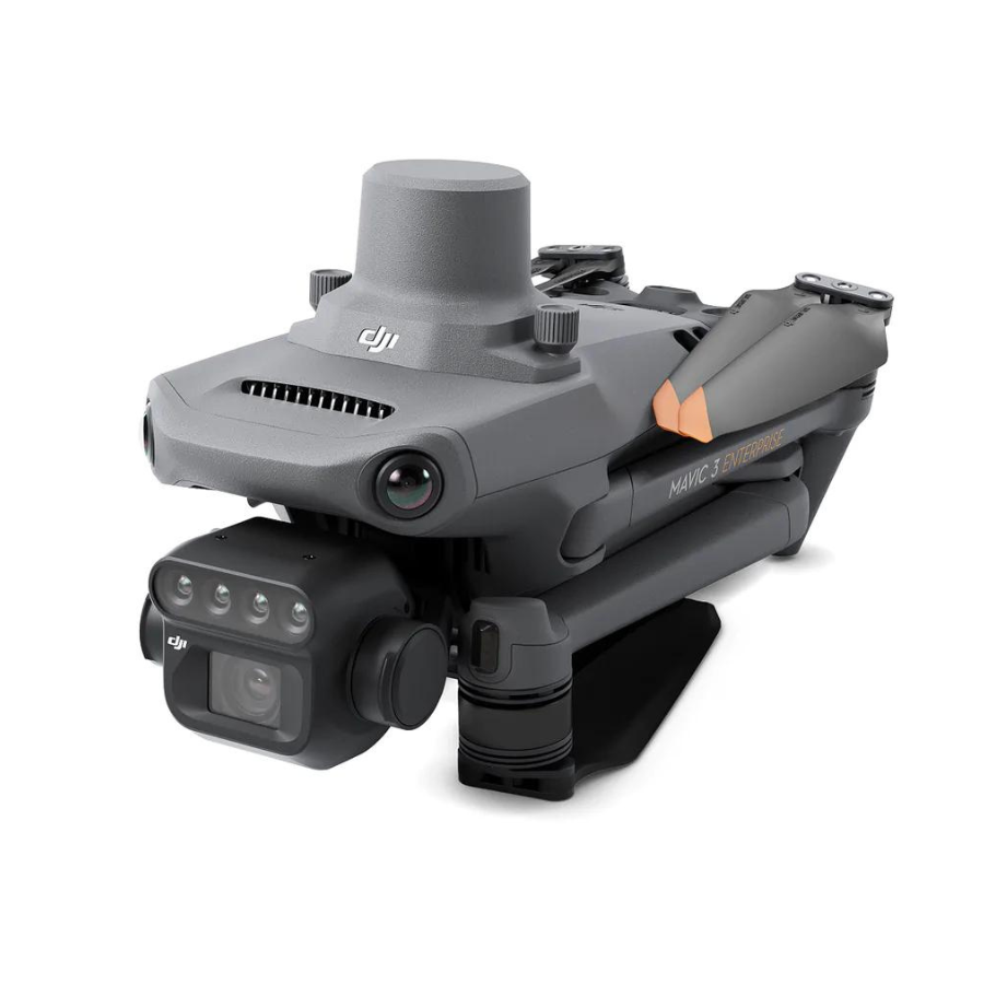
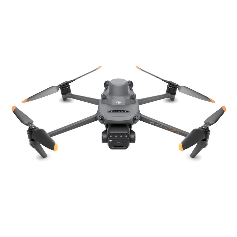
The DJI Mavic 3 Multispectral Drone with Shoulder Bag Kit is an advanced and versatile aerial solution designed specifically for agricultural applications. This comprehensive kit includes the DJI Mavic 3 drone, equipped with a high-resolution multispectral camera, and a convenient shoulder bag for easy transportation. The Mavic 3 Multispectral Agriculture Drone features powerful flight performance, enabling precise and efficient data collection over large agricultural areas. Its multispectral camera captures imagery in multiple spectral bands, providing valuable insights into crop health, irrigation management, and nutrient levels. This data can help farmers make informed decisions and optimize their agricultural practices.
Efficient and reliable battery life
Efficient and Reliable Battery Life
The DJI Mavic 3 Multispectral Drone is engineered to maximize efficiency in the field with its extended flight time, allowing operators to cover vast farmlands in a single mission. This ensures consistent data collection without frequent battery swaps, saving both time and effort during large-scale agricultural surveys.
Its intelligent battery management system enhances reliability by optimizing power usage, monitoring health, and providing real-time status updates. This not only extends the overall lifespan of the batteries but also guarantees safe, uninterrupted operations—empowering farmers and agronomists to focus on precision tasks with confidence.
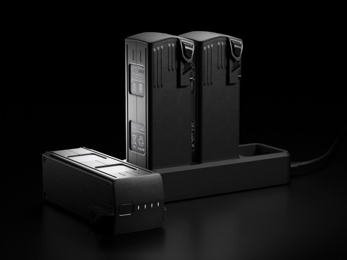
Fast Charging
With the ability to sustain long-duration flights, the drone minimizes downtime between missions, making it highly effective for frequent crop monitoring cycles. Farmers can schedule regular aerial surveys without worrying about power interruptions, ensuring they always have up-to-date insights into crop conditions.
In addition, the DJI Mavic 3 Multispectral Drone quick-charging capabilities further enhance operational efficiency. Batteries can be replenished swiftly, reducing waiting times and allowing for back-to-back missions when time-sensitive data collection is required. This combination of endurance and convenience makes it a reliable partner for modern precision agriculture.
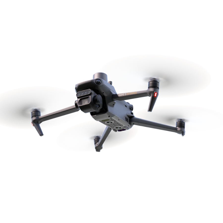
Omnidirectional obstacle sensing, terrain-follow aerial surveying
The aircraft features multiple wide-FOV vision sensors that accurately detect obstacles in all directions for omnidirectional obstacle avoidance. The terrain-follow aerial surveying can be easily performed in steep-slope landscapes.
The DJI Mavic 3 Multispectral Drone brings efficiency and precision to aerial surveying in agriculture with its advanced multispectral and global shutter cameras, ensuring distortion-free, high-quality data capture. Equipped with GPS and RTK technology, it delivers centimeter-level accuracy for mapping and treatment planning, while specialized flight modes automate survey routes for consistent coverage. With extended flight time and real-time data processing, the Mavic 3M enables farmers to quickly turn aerial insights into actionable decisions that boost productivity and optimize resource use.
With seamless integration into DJI Terra and DJI SmartFarm Web, the Mavic 3M simplifies the entire mapping workflow from data collection to analysis. Farmers can generate accurate 2D and 3D maps, monitor crop health, and analyze multispectral data directly within these platforms. Automated processing and visualization tools make it easy to identify problem areas, plan targeted interventions, and optimize farm management strategies—all in one streamlined ecosystem.
DJI Mavic 3 Multispectral Drone is designed to make agricultural drone operations simple, efficient, and highly effective. With automated flight modes, real-time monitoring, and intelligent obstacle avoidance, it ensures safe and accurate missions across diverse farming environments. Its portability and quick deployment allow farmers to easily survey fields, capture multispectral data, and process insights with minimal effort. By streamlining daily operations, the Mavic 3M empowers growers to save time, reduce costs, and achieve better outcomes in precision farming.
The DJI Mavic 3M, operators can generate precise 3D flight routes tailored to the contours of farmland and terrain. This ensures accurate coverage even in complex environments such as hillsides or uneven fields, improving the consistency of data collection. By following 3D routes, the drone minimizes overlap, reduces missed areas, and enables smarter, more efficient surveying—helping farmers achieve reliable insights with fewer resources and less effort.
Features
| Feature | Description |
|---|---|
| Multispectral Imaging Technology | DJI Mavic 3 Multispectral Drone is equipped with advanced multispectral imaging technology, capturing data across various spectral bands for precise crop health assessment, growth monitoring, and optimized agricultural practices (NDVI, NDRE). |
| Precision Agriculture Flight Modes | Specialized flight modes automate data collection over farmlands, ensuring consistent coverage and image capture for effective crop monitoring. |
| Integrated Data Analysis Tools | Robust tools process multispectral images quickly, delivering actionable insights on crop health, soil conditions, and irrigation needs to improve yield and resource efficiency. |
| Real-Time Data Transmission | Immediate data transmission allows for rapid decision-making and timely interventions for better crop management. |
| Extended Flight Time | DJI Mavic 3 Multispectral Drone has long flight duration which allows for surveying large areas in one operation, enabling regular and detailed monitoring without frequent interruptions. |
| GPS Precision Farming | High-precision GPS technology enables accurate mapping, boundary recognition, and optimized treatment planning, reducing overlap and improving efficiency. |
| Enhanced Connectivity for Remote Operations | 4G and Wi-Fi connectivity allow for easy remote management, even across vast agricultural zones. |
| Weather-Resistant Design | Durable construction ensures reliable performance in various weather conditions, allowing uninterrupted data collection. |
| Portable and Easy to Deploy | Compact, foldable design allows for quick deployment and easy transport across multiple locations. |
| Global Shutter Mechanism for High-Quality Imaging | Global shutter ensures distortion-free, high-quality multispectral images for accurate analysis and data-driven decisions. |
| Obstacle Avoidance System | Intelligent obstacle sensing helps prevent collisions with trees, buildings, and other hazards, enhancing flight safety. |
| Automated Data Processing Workflow | DJI Mavic 3 Multispectral Drone speeds up the transition from data collection to actionable insights, allowing for timely responses that impact crop outcomes. |
| Seamless Integration with Farm Management Software | Easily integrates with farm management platforms to streamline data workflows and improve operational efficiency. |
| Free DJI Pilot 2 | Includes DJI Pilot 2 flight control app for mission planning, real-time monitoring, and integration with DJI’s ecosystem. Some advanced features may require additional licensing. |
Specifications
General
General Specifications
| Feature | Specification |
|---|---|
| Takeoff Weight | Approx. 951 g |
| Dimensions (Folded) | 212 × 96.3 × 90.3 mm (L×W×H) |
| Dimensions (Unfolded) | 347.5 × 283 × 139.6 mm (L×W×H) |
| GNSS | GPS + GLONASS + BeiDou + Galileo |
| Internal Storage | None (microSD required) |
| Protection Rating | IP54 (sensors only) |
Flight Performance
| Feature | Specification |
|---|---|
| Max Ascent Speed | 6 m/s |
| Max Descent Speed | 6 m/s |
| Max Horizontal Speed | 15 m/s |
| Max Flight Time | Up to 43 mins |
| Max Wind Resistance | 12 m/s |
| Max Transmission Range | 15 km (FCC) |
Operating Conditions
| Feature | Specification |
|---|---|
| Operating Temperature | 0°C to 40°C |
Camera & Imaging
| Feature | Specification |
|---|---|
| RGB Camera | 4/3″ CMOS, 20 MP, Mechanical Shutter |
| Multispectral Cameras | 4× 5 MP (G, R, RE, NIR), Global Shutter |
| Multispectral Resolution | 1280 × 1024 per channel |
| Sunlight Sensor | Integrated, real-time radiometric correction |
| Focal Length (Multispectral) | 5.7 mm (FOV: 61.2°) |
Photography & Video
| Feature | Specification |
|---|---|
| Photo Formats | JPEG, DNG (RGB); TIFF (multispectral) |
| Video Resolutions | RGB only: up to 5.1K @ 50fps |
| Multispectral Video | Not supported |
| Shutter Type | Mechanical (RGB), Global (Multispectral) |
Stabilization & Sensing
| Feature | Specification |
|---|---|
| Gimbal | 3-axis (tilt, roll, pan) |
| Obstacle Sensing | Omnidirectional Vision + Infrared |
Connectivity
| Feature | Specification |
|---|---|
| Transmission System | OcuSync 3.0 Enterprise |
| Controller | DJI RC Pro Enterprise (Built-in screen) |
| RTK Module | Supports Real-Time Kinematic positioning |
Battery & Charging
| Feature | Specification |
|---|---|
| Battery Model | DJI Mavic 3 Intelligent Flight Battery |
| Capacity | 5000 mAh, 77 Wh |
| Charging Hub | DJI 100W or 65W USB-C Hub |
| Charging Time | Approx. 60–90 minutes (depending on charger) |
FAQs
What is the DJI Mavic 3 Multispectral Drone used for in agriculture?
The DJI Mavic 3 Multispectral Drone is designed to help farmers and agronomists monitor crop health, optimize yields, and make informed decisions. It captures both RGB and multispectral data, making it perfect for precision agriculture applications like crop scouting, vegetation analysis, and irrigation planning.
What makes DJI Mavic 3 Multispectral Drone different from the regular DJI Mavic 3?
Unlike the standard version, the Mavic 3 Multispectral has a built-in multispectral camera system (including Green, Red, Red Edge, and Near Infrared bands) alongside a regular RGB camera. This allows it to collect data invisible to the human eye—critical for evaluating plant health.
How can farmers benefit from multispectral imaging?
DJI Mavic 3 Multispectral Drone imaging helps detect crop stress, pests, and disease early. With accurate NDVI and other vegetation indices, farmers can take targeted action, reduce waste, and improve productivity.
What is the flight time of the Mavic 3 Multispectral?
The DJI Mavic 3 Multispectral Drone offers a flight time of up to 43 minutes, which allows for efficient coverage of large farmland areas in a single session.
Can it work with agricultural software platforms?
Yes, it integrates seamlessly with DJI Terra and DJI SmartFarm, as well as other third-party precision ag software for mapping, analysis, and reporting.
How accurate is the data captured by this drone?
It supports RTK (Real-Time Kinematic) positioning, enabling centimeter-level accuracy, which is essential for high-precision field mapping and analysis.
Is the Mavic 3 Multispectral easy to use for non-technical users?
Absolutely. It’s compact, quick to deploy, and comes with intuitive mission planning software. Even users new to drone tech can fly pre-set routes and collect valuable data with ease.
Can it be used for crop spraying or just data collection?
The DJI Mavic 3 Multispectral Drone is designed specifically for data collection, not spraying. However, it can guide spraying drones more efficiently by identifying problem areas in the field.
What is the transmission range of this drone?
It features OcuSync 3.0 transmission with a range of up to 15 km (FCC), ensuring stable, real-time image and data transmission even across large farmlands.
Is it safe to fly in varying weather conditions?
While DJI Mavic 3 Multispectral Drone is durable and reliable, it’s best to avoid flying in heavy rain or strong winds. For optimal results, fly under clear weather to ensure accurate data capture.
Explore Our Drone Fleet
Explore Our Full Range of Advanced Drone Solutions


Reviews
There are no reviews yet.