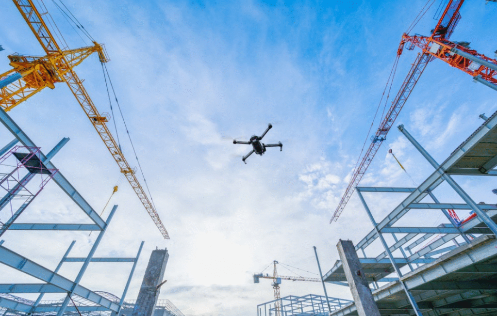
Construction Drone Workflows for Mapping, Volumetrics and Stakeholder Updates
Construction drone workflows describe how data moves from the sky into daily decisions on site. Well-designed construction drone workflows usually start with planned, repeatable flights over key areas, continue through automated processing in mapping or reality-capture software, and end with clear outputs for project managers, engineers, and commercial teams. When construction drone workflows are standardized in this way, they stop being “experiments” and become a normal, reliable part of project delivery, like site diaries or progress meetings.
The biggest value of construction drone workflows is that they compress time between reality on the ground and information on the screen. Instead of waiting days for survey crews or occasional helicopter shoots, teams can launch regular drone flights that capture imagery, point clouds, and elevation data in a single visit. Those datasets flow into BIM, GIS, and project-control platforms, so construction drone workflows support progress tracking, cut-and-fill measurement, clash detection, and subcontractor verification with fresh, objective evidence rather than outdated drawings or guesswork. That frequency and consistency give planners, QS teams, and site managers a shared “single source of truth.”
Mature construction drone workflows also help justify investment in in-house pilots and enterprise software rather than one-off outsourcing. When flights, uploads, processing, QA checks, and reporting are defined as repeatable steps, it becomes easy to scale from a few pilot projects to dozens of concurrent sites. Leadership can see how construction drone workflows translate into fewer site visits, faster valuations, reduced rework, and stronger safety by keeping people away from edges, scaffolds, and live plant. Over time, these gains compound, turning drones from a nice-to-have visual tool into a core part of how modern construction organizations plan, monitor, and hand over projects.
Types of Drones Used on Construction Sites
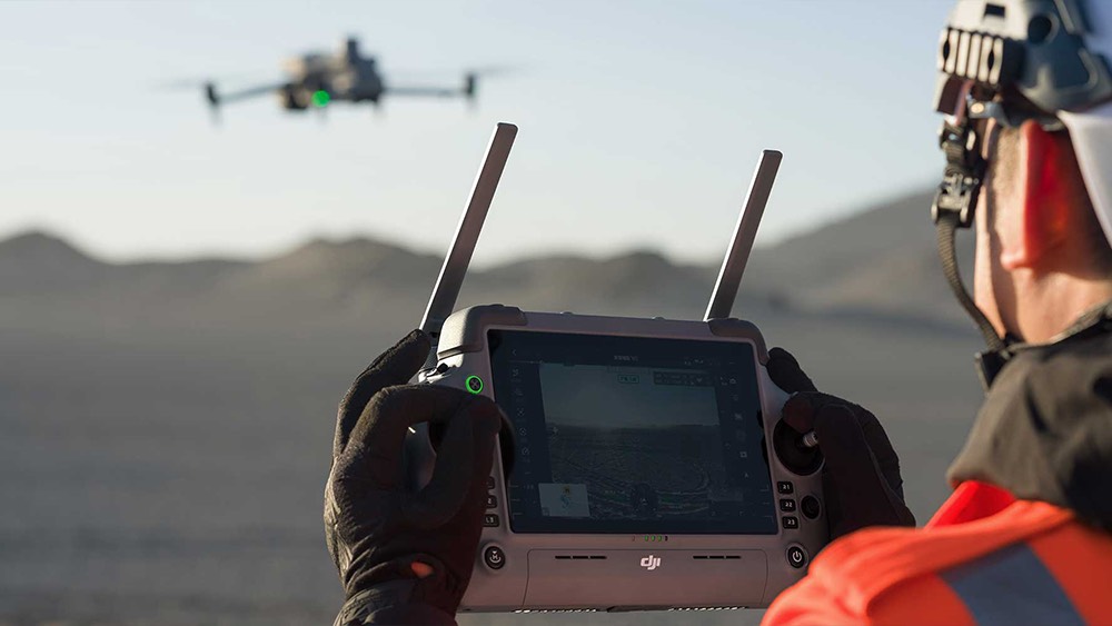
On modern sites, several drone categories play distinct roles inside construction drone workflows, and choosing the right mix determines how efficient and accurate those workflows become. Construction drone workflows typically combine fast, flexible multirotors for day‑to‑day progress monitoring with long‑endurance fixed‑wing or VTOL aircraft for large mapping jobs. As these construction drone workflows mature, teams often standardize on one or two platforms per use case so data is consistent and easy to compare over the life of a project.
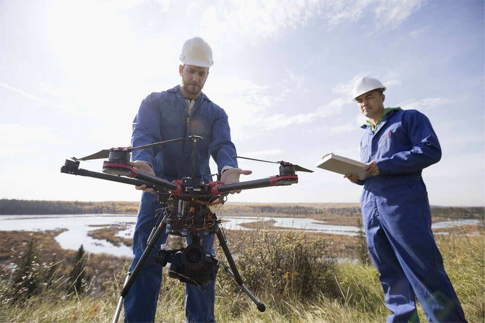
Multirotor / quadcopter drones
These are the workhorses for most construction drone workflows, handling frequent progress photos, short mapping flights, façade checks, and close‑up inspections. Their ability to hover, fly low and slow, and operate in tight urban sites makes them ideal for capturing repeatable viewpoints for reports and stakeholder updates.Fixed-wing mapping drones
Fixed‑wing aircraft cover large areas quickly and efficiently, making them valuable where construction drone workflows must deliver accurate terrain models or volumetric surveys over big earthworks or linear projects. They typically require more open space for launch and recovery but provide longer flight times and higher productivity on each mission.Hybrid VTOL (fixed-wing + vertical takeoff)
Hybrid VTOL platforms combine runway‑free vertical takeoff with fixed‑wing cruising, filling a key gap in construction drone workflows on remote or constrained sites. They can be launched from a small pad, climb vertically, then transition to forward flight for long‑range mapping before landing back in a compact footprint.Heavy‑lift / enterprise platforms
Larger enterprise drones carry LiDAR, high‑zoom cameras, or multi‑sensor payloads that expand what construction drone workflows can measure. They support precision as‑built verification, detailed structural inspections, and night or thermal surveys, though they demand stricter planning, trained pilots, and robust safety procedures.Micro / sub‑250 g drones
Small, lightweight drones are increasingly used to complement outdoor construction drone workflows with quick interior or “last‑meter” checks. They are useful for flying inside partially built structures, documenting MEP installations, or grabbing fast visual updates when larger drones would be impractical or over‑kill.

Progress Monitoring and Visual Documentation
Progress monitoring and visual documentation are often the first use cases when teams design construction drone workflows. By flying consistent routes on a weekly or biweekly schedule, drones capture high-resolution images and video that document exactly what has changed on site, from earthworks and foundations to façade progress and MEP installation. When these construction drone workflows are standardized, stakeholders gain a reliable visual timeline that supports claims, reduces disputes, and keeps everyone aligned on what “finished” really looks like.
In well-run construction drone workflows, progress data is captured with repeatable camera angles and waypoints so the same views can be compared over time. Orthomosaic maps, 3D models, and geo‑tagged progress photos are then pushed into BIM, CDE, or project‑management platforms, where planners and QS teams overlay them with design drawings and schedules. This makes it easy to spot delays, out‑of‑sequence work, or missing elements early, using objective imagery rather than subjective site notes, which strengthens both commercial control and quality assurance.
Construction drone workflows for visual documentation also create a powerful communication tool beyond the core project team. Curated progress snapshots and fly‑through videos can be shared with clients, lenders, and regulators to demonstrate milestones, support valuations, and evidence compliance with safety or environmental commitments. Internally, the same visual record becomes training material and a lessons‑learned archive for future projects. In this way, construction drone workflows turn routine flights into a strategic asset that improves transparency, reduces risk, and enhances trust across the entire delivery chain.
ROI: Cost, Time Savings and Risk Reduction
ROI from construction drones comes from three main areas: lower costs, faster workflows, and better risk control. Studies and case projects show that drone-based surveys and inspections can cut inspection or survey time by 50–60%, with labor cost savings of around 20–30% compared with traditional methods like manual topographic surveys or helicopter shoots. By catching clashes, over‑excavation, and dimensional errors earlier, companies also avoid expensive rework, change orders, and schedule overruns that quickly dwarf the initial investment in hardware and software.
Time savings show up not only in faster data capture but also in decision-making. Instead of waiting days or weeks for updated drawings or as‑built measurements, project managers can launch a short mapping flight and have processed outputs—orthomosaics, 3D models, volume reports—within hours. That compresses the cycle between site reality and office decisions, which keeps procurement, sequencing, and subcontractor coordination aligned with what is actually happening on the ground. Some case studies report overall project ROI improvements of 15–25% once drones are fully embedded in standard workflows, driven largely by fewer delays and more predictable cash flow.
Conclusion
Construction drone workflows are no longer experimental add-ons; they are becoming part of the core digital backbone of modern projects. By standardizing how flights are planned, data is captured, processed, and shared, construction drone workflows turn a flying camera into a reliable engine for progress tracking, measurement, and coordination. When teams know that fresh maps, 3D models, and photo records will be available on a predictable rhythm, they start to depend on this aerial view for everything from weekly coordination meetings to commercial decisions and handover documentation.
The real power of construction drone workflows lies in how they connect site reality with office decision-making. Regular flights feed accurate terrain models, stockpile volumes, and progress imagery into BIM, CDE, and project-control systems, closing the gap between drawings and what is actually built. This lets planners spot clashes early, QS teams validate claims with objective evidence, and managers re-sequence work before delays snowball. At the same time, safety teams can inspect roofs, edges, and hazardous areas remotely, while leadership and clients gain transparent, visual insight into how the project is evolving without needing to walk the site every week.
As organizations mature, construction drone workflows expand from a few pilots to an enterprise capability: in‑house operators, standard operating procedures, integrated cloud platforms, and clear KPIs for cost, time, and risk. Sites that previously relied on ad‑hoc photos or sporadic surveys begin to run on consistent aerial intelligence, improving resource allocation and reducing disputes. In this context, investment in drones, training, and software is less about owning impressive hardware and more about embedding a faster, safer, data‑driven way of working. Done well, construction drone workflows help companies deliver projects with tighter margins, fewer surprises, and a level of visual accountability that traditional methods simply cannot match.