The Science of Underwater Drone Technology: Stabilization, Navigation and Data Links
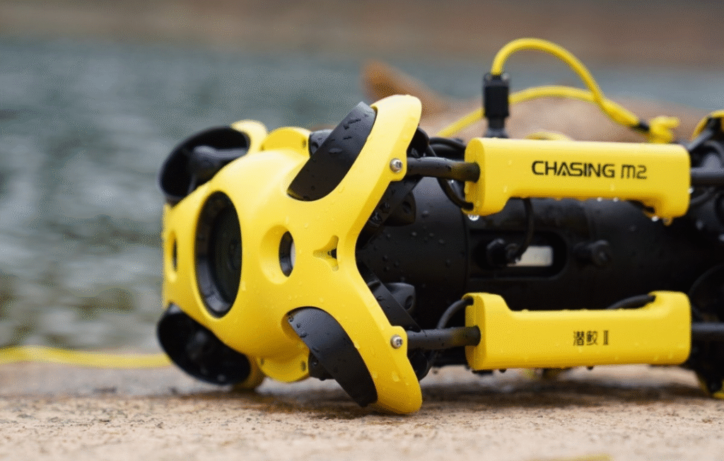
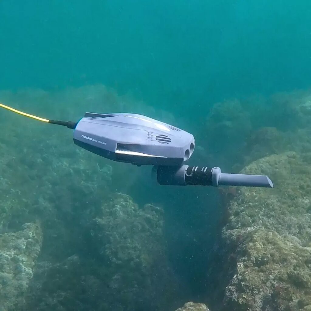
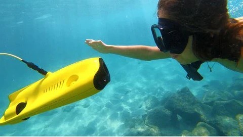
The rise of underwater drone technology marks a major breakthrough in ocean exploration, inspection, and research. Unlike traditional submersibles, underwater drone technology puts advanced sensors, cameras, and real-time control systems into a compact, maneuverable vehicle, allowing users to reach challenging environments such as deepwater pipelines, wrecks, and sensitive ecosystems. Driven by both tethered and battery-powered models, underwater drone technology now enables safe, precise, and repeatable access to underwater sites without the logistical complexity or risk of human dives.
A defining advantage of underwater drone technology is its sensor fusion. Modern underwater drones combine high-definition cameras, sonar, and environmental sensors to yield wide situational awareness even in dark, murky, or turbulent waters. Cameras provide crisp imagery while sonar, echo sounders, and inertial measurement units enable mapping, obstacle avoidance, and location tracking. Automated depth, pitch, roll, and heading sensors let operators maintain stable flight paths, and sophisticated control consoles deliver intuitive piloting with live video streams and map overlays. Propulsion systems, typically using magnetically coupled thrusters, ensure fine maneuverability in all directions for precise inspection tasks and safe navigation near sensitive features.
Underwater drone technology supports a diverse set of applications, from infrastructure inspection and environmental monitoring to search-and-rescue, marine biology, and archaeological surveys. Innovations in battery systems and more robust tethers mean drones can be deployed from virtually any platform, operate in adverse conditions, and stream actionable data in real time to shore or ship-based control centers. The evolution of underwater drone technology continues to lower barriers for ocean discovery, making sub-sea mapping, sample collection, and safety inspections more accurate, scalable, and cost-effective than ever before.
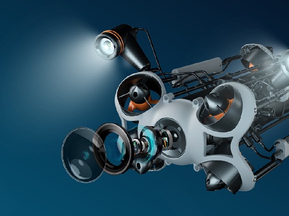
Core Hardware: Frame, Thrusters and Power System
Core hardware is what makes underwater drone technology physically capable of surviving pressure, moving in three dimensions, and staying powered long enough to complete missions. In most designs, underwater drone technology centres on a sealed frame or pressure hull, multiple vectored thrusters, and a carefully engineered power system that balances endurance, safety, and weight. Together, these elements turn underwater drone technology from a concept into a reliable subsea workhorse.
Pressure‑resistant frame
The frame is a rigid, hydrodynamic skeleton that protects electronics and payloads from high pressure and corrosion. Typically built from aluminium, composites, or syntactic foam, it also defines mounting points for thrusters, cameras, and lights, ensuring the underwater drone technology stays structurally stable during manoeuvres.Thrusters for 6‑DOF movement
Underwater drone technology uses multiple electric thrusters arranged along different axes to achieve forward, reverse, lateral, vertical, and rotational movement. Brushless DC motors with shrouded propellers are common, delivering efficient thrust while minimising the risk of entanglement and enabling precise station‑keeping in currents.Buoyancy and trim control
To maintain near‑neutral buoyancy, the frame is paired with floats, ballast, or internal buoyancy tanks. This allows the vehicle to hover with minimal power draw and hold depth accurately. Good buoyancy design also keeps underwater drone technology stable when carrying different tool payloads or sensors.Battery packs and power management
Most systems rely on high‑energy‑density lithium‑ion battery packs housed in sealed compartments. Smart power-management electronics monitor voltage, temperature, and current, preventing over‑discharge or overheating. Hot‑swappable or removable batteries minimise downtime and support longer field operations.Internal electronics bay
A dedicated electronics bay houses the main computer, motor controllers, navigation sensors, and communication interfaces. Careful thermal design and watertight connectors keep these components safe while still allowing upgrades. This modularity lets operators tailor underwater drone technology to tasks ranging from simple video inspection to advanced survey missions.
Vision and Imaging: Cameras, Lights and Video Streams
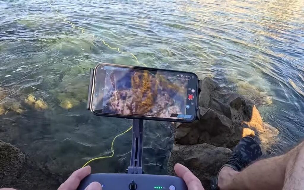
Vision and imaging sit at the heart of underwater drone technology, turning raw movement through water into meaningful insight. Instead of relying on natural light, underwater drone technology combines low‑light cameras, high‑output LEDs, and smart image processing to cut through darkness and turbidity. Together with live video streaming over the tether, this imaging stack lets pilots “see” in real time, document assets, and make fast decisions from the surface.
Modern systems typically use wide‑angle, high‑definition cameras mounted on tilt or pan‑tilt modules, giving a flexible field of view without constantly rotating the whole vehicle. Paired with powerful, dimmable LED arrays, underwater drone technology can illuminate targets at close range while minimising backscatter from suspended particles. Features like auto‑exposure, white‑balance tuning, and digital noise reduction keep footage usable for inspections, documentation, and later analysis.Beyond simple video, underwater drone technology increasingly supports multiple imaging modes and streaming options.
Control Systems and Navigation: Stabilization, Autopilot and Positioning underwater drone technology
The control systems and navigation capabilities of underwater drone technology are what enable stable movement, precise piloting, and even evolving forms of autonomy beneath the waves. Unlike aerial drones, underwater drone technology cannot use GPS directly, so it relies on a suite of specialized sensors ‒ combining data in real time to maintain position, chart paths, and stabilize itself in a dynamic environment dominated by currents, darkness, and poor visibility.
Sensor fusion for stabilization
Underwater drone technology integrates inertial measurement units (IMUs), depth sensors, gyroscopes, and often Doppler velocity logs (DVLs) to calculate roll, pitch, yaw, and movement. These constantly fire thrusters to counter drift, stabilize heading, and hold a precise station in currents ‒ even without visual cues or GPS.Terrain-aided and acoustic navigation
When GPS drops out, underwater drone technology leverages sonar and acoustic positioning systems like USBL (Ultra-Short Baseline) to track its position. These systems triangulate beacons on the drone and surface stations for real-time mapping, while sonar also aids in obstacle avoidance and environmental awareness.Autopilot and waypoint programming
Advanced underwater drone technology allows pilots to pre-plan missions, assigning waypoints, grid surveys, or search patterns. The onboard autopilot system then takes over, following set paths and autonomously correcting its course, much like an aerial drone would above water.Return-to-home and fail-safes
To prevent loss, underwater drone technology is equipped with “return-to-home” logics based on tether length, elapsed time, sonar references, or surfacing protocols. If control is lost, the drone will either hover, surface, or return toward its launch point automatically, greatly improving mission security.Intuitive control interfaces
Modern underwater drone technology pairs these autonomous features with user-friendly control consoles, live video and navigation displays, and responsive joysticks or touchscreen apps. Data visualization helps operators interpret the drone’s position, heading, and orientation instantly, so both expert and new users can pilot with confidence—even in featureless or low-visibility environments.

Key Civil and Industrial Applications
| Application Area | How Underwater Drone Technology Is Used |
|---|---|
| Port and harbor inspection | Inspect quay walls, pilings, moorings, and hulls for damage, corrosion, and marine growth without sending divers. |
| Offshore oil & gas | Examine rigs, subsea manifolds, risers, and pipelines for leaks, coating failure, or structural issues in high‑risk zones. |
| Renewable energy (offshore wind, tidal) | Monitor turbine foundations, cables, and anchors, supporting maintenance and environmental compliance. |
| Drinking water and reservoirs | Inspect dams, intake structures, and storage tanks to detect cracks, sediment buildup, or contamination sources. |
| Civil infrastructure | Survey bridge piers, submerged tunnels, and floodgates, creating visual records for engineering assessments. |
| Aquaculture & fisheries | Check nets, cages, feeding systems, and fish health while reducing stress and manual diving effort. |
| Environmental monitoring | Map habitats, track pollution plumes, and record seafloor conditions for conservation and regulatory studies. |
| Search and rescue / recovery | Locate submerged vehicles, evidence, or victims in rivers, lakes, and coastal zones with cameras and sonar. |
| Marine archaeology & heritage | Document wrecks and submerged sites with high‑resolution imagery and 3D reconstruction. |
| Mining and dredging | Monitor excavation fronts, slurry lines, and sediment levels to optimise operations and ensure safety. |
| Shipbuilding and repair | Conduct pre‑dock and post‑repair hull surveys, propeller checks, and anode inspections directly at berth. |
| Research and education | Support universities and labs in studying marine biology, robotics, and underwater engineering with real‑world data. |
Autonomous Features and AI Underwater
Autonomous features and AI are pushing underwater drone technology beyond simple remote control into true robotic collaboration beneath the surface. As processors become more efficient and sensors more compact, underwater drone technology can now execute pre-planned missions, react to changing conditions, and make basic decisions without constant pilot input. This shift turns underwater drone technology into a force multiplier for survey, inspection, defence, and environmental projects operating in complex, data-rich seascapes.
Adaptive mission execution
AI-enabled controllers let drones follow waypoints, grid patterns, or depth contours while automatically adjusting speed, heading, and altitude to currents or obstacles. If visibility drops or terrain changes, the vehicle can alter its path to maintain coverage, then log where conditions prevented data capture for follow-up.Intelligent obstacle avoidance
Computer vision, sonar interpretation, and machine-learning models work together to classify obstacles—such as rocks, pilings, nets, or cables—and steer safely around them. Instead of merely stopping on contact, the drone can choose alternative routes, reducing the risk of entanglement and keeping missions on schedule.Automated target detection and tracking
Onboard AI can highlight anomalies like leaks, cracks, unusual shapes, or temperature differences in real time. Once a feature of interest is found, the drone can lock onto it, orbit for closer inspection, or collect higher‑resolution imagery and measurements, improving consistency compared with manual piloting alone.Collaborative swarms and docking
Some advanced systems support multi-vehicle coordination and subsea docking. Fleets can divide large survey areas into sectors, share mapping progress, and relay data or commands between units. Docking stations on the seafloor or under vessels enable autonomous recharging and data offload, extending mission duration dramatically.Onboard analytics and data compression
Instead of streaming every raw frame, AI models can pre-filter footage, tag key events, and compress only the most relevant data for transmission. This reduces bandwidth demands over long tethers or acoustic links and allows teams to focus immediately on actionable insights rather than sifting through hours of unstructured video.
Conclusion
Underwater drones are rapidly evolving from simple tethered cameras into sophisticated, semi‑autonomous robots that can think and adapt beneath the surface. Autonomous features and AI underwater are reshaping how missions are planned, executed, and analysed, allowing fleets to survey larger areas, react to changing conditions, and extract insights with far less manual piloting. In this context, underwater drone technology is shifting from a niche tool for specialists into a mainstream platform for ports, energy companies, scientists, and emergency teams that need reliable subsea intelligence.
A key pillar of autonomy in underwater drone technology is the ability to follow missions with only high‑level human input. Operators can define waypoints, depth bands, or search grids, and the vehicle automatically handles course‑keeping, depth control, and speed adjustments while logging every metre it travels. Layered on top, AI models interpret sensor feeds—video, sonar, and environmental data—to detect anomalies such as leaks, cracks, unusual shapes, or temperature changes and then trigger behaviours like pausing, circling, or capturing extra imagery. This transforms underwater drone technology from a remote camera on a tether into an active assistant that helps decide what is worth inspecting more closely.
Looking ahead, the combination of swarm coordination, subsea docking, and onboard analytics will make underwater drone technology even more autonomous and persistent. Multiple vehicles will be able to divide up large inspection corridors, share maps and targets, and hand off tasks as batteries deplete or new priorities emerge. Docking stations on the seabed or under ships will enable automatic recharging and data upload, while edge AI compresses and prioritises only the most important findings for human review. As these capabilities mature, autonomous features and AI underwater will not replace human judgment but will extend it—turning the deep ocean from a largely invisible frontier into a continuously monitored, data‑rich environment.