Autonomous Drone Swarm Imaging: Detecting Hidden Anomalies in Dense Vegetation
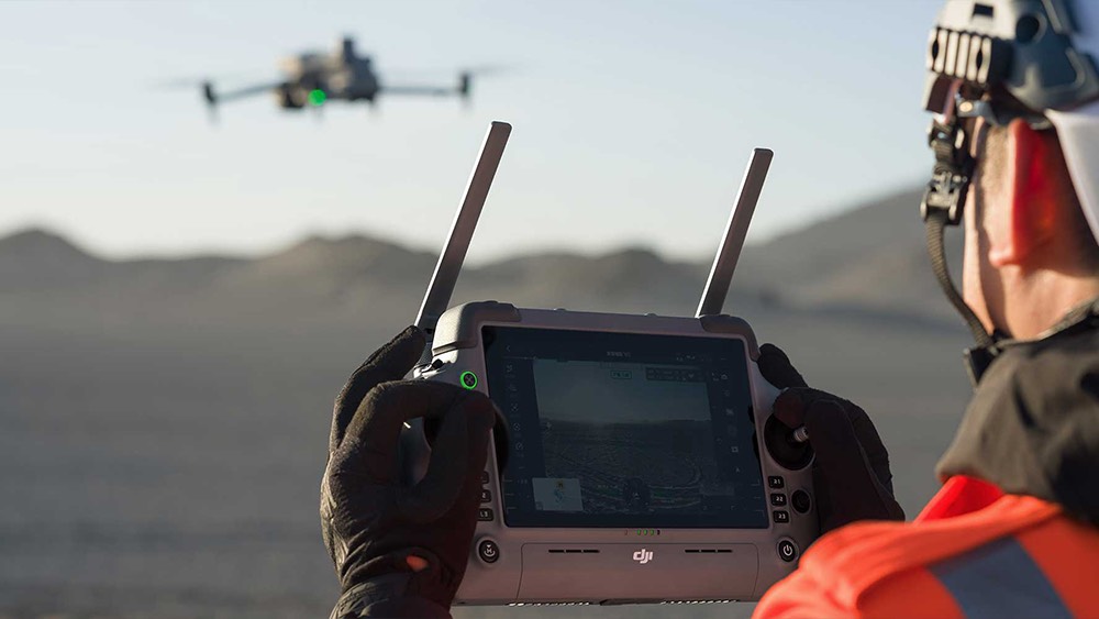
An autonomous drone swarm represents a fundamental shift from single‑drone missions to coordinated, multi‑vehicle operations guided by shared intelligence rather than manual piloting. In an autonomous drone swarm, each aircraft carries its own sensors and onboard computing, but continuously exchanges data with the rest of the group to make collective decisions in real time. This allows the swarm to adapt its formation, redistribute tasks, and re‑plan routes when conditions change, without waiting for detailed human instructions.
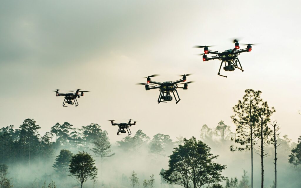
Because of this distributed decision-making, an autonomous drone swarm can cover larger areas, react faster to emerging events, and remain resilient even if individual drones fail.The power of an autonomous drone swarm becomes clear in complex environments such as dense forests, disaster zones, or contested airspace. Instead of relying on a single viewpoint, dozens of drones build a composite picture of the scene, combining overlapping camera feeds, thermal imaging, and other sensors into a unified situational map.
When looking for anomalies—like missing people, hidden vehicles, or hotspots—each drone contributes partial observations that the swarm fuses into high‑confidence detections, even when targets are heavily obscured by vegetation or dust. This multi‑angle coverage dramatically improves precision and recall compared to traditional aerial imaging, while also shortening the time needed to search large or rugged areas. In practice, an autonomous drone swarm can maintain continuous surveillance, rotate units for charging, and still keep a persistent “eye” on critical locations.
Core Technologies Behind Autonomous Drone Swarms
Core technologies behind autonomous drone swarms combine advanced hardware, intelligent software, and resilient networking so multiple UAVs can act as one coordinated system. Together, these elements enable real-time sensing, collective decision-making, and adaptive formations without continuous human control. Each drone becomes both a sensor and a computing node, while the swarm’s algorithms manage how they communicate, avoid collisions, and respond to changing mission conditions.
Swarm intelligence algorithms
Swarm behavior is driven by algorithms inspired by nature, such as particle swarm optimization, ant colony optimization, and simple “separate–align–cohere” rules. These models govern spacing, alignment, and cohesion, allowing an autonomous drone swarm to spread out to search, then tighten formation to track a target or navigate obstacles as a coordinated unit.Onboard sensors and computer vision
Each drone typically carries RGB and thermal cameras, LiDAR or depth sensors, and inertial measurement units. Computer vision and sensor fusion run locally to detect obstacles, estimate position, and identify anomalies or targets. This rich sensing layer lets an autonomous drone swarm map environments in 3D, see through smoke or darkness, and maintain safe separation in cluttered spaces.Edge computing and AI onboard
High-performance processors on each aircraft run AI models for perception, path planning, and local decision-making. Instead of streaming everything to a ground station, drones process data at the edge, reducing latency and bandwidth needs. This enables an autonomous drone swarm to react within milliseconds to sudden changes, like moving targets or new hazards.High-bandwidth, resilient communications
Robust mesh networking links all units so telemetry, intent, and summarized sensor data can be shared across the group. If one node fails or a link degrades, data routes around it automatically. This communication fabric ensures an autonomous drone swarm maintains situational awareness and coordinated behavior even in challenging RF environments.Cooperative navigation and safety systems
Advanced navigation blends GNSS, RTK, visual odometry, and SLAM so swarms can operate accurately even with weak GPS. Collision-avoidance logic enforces minimum separation, altitude deconfliction, and geofencing. These safety layers allow an autonomous drone swarm to scale from a handful of drones to dozens or more while protecting people, property, and the fleet itself.
Coordination, Communication and Decision-Making
Swarm intelligence is the “brain” that allows multiple drones to behave as a coherent team instead of a set of independent aircraft. It draws inspiration from bird flocks, fish schools, and insect colonies, where simple local rules between agents create complex, adaptive group behavior. In drone swarms, these principles translate into distributed algorithms that govern spacing, alignment, task sharing, and collective motion, so the group can explore, converge, or disperse without constant human input.
Coordination in a swarm relies on each drone reacting to local information—such as neighbor positions, velocities, and obstacles—while following shared rules that keep the formation stable and collision‑free. Some architectures use a leader–follower model, while others are fully decentralized, with no single point of control. In both cases, coordination ensures that coverage is maximized, gaps are minimized, and the swarm can reconfigure dynamically if drones fail or mission priorities change.
Communication and decision-making tie this all together. Low‑latency wireless links let drones exchange status, sensor cues, and intent, enabling consensus algorithms to agree on targets, routes, or next actions. Instead of one global command, decisions emerge from many small updates as each drone refines its behavior based on shared data. This makes swarms robust under uncertainty: even with partial information or intermittent links, the collective can still route around failures, adapt to threats, and complete complex tasks with far more resilience than any single UAV.
Industrial and Infrastructure Use Cases
| Use Case | How Swarms Add Value |
|---|---|
| Power line and grid inspection | Multiple drones fly parallel corridors, capturing synchronized RGB and thermal data to spot hotspots, damaged insulators, or vegetation risks in a single pass instead of many separate missions. |
| Pipeline and canal monitoring | Swarms patrol long linear assets, automatically flagging leaks, erosion, encroachments, or structural anomalies, enabling rapid intervention and reducing the need for risky ground patrols. |
| Rail and road corridor surveys | Coordinated drones map tracks, bridges, and highways from multiple angles, producing detailed 3D models and condition reports that support maintenance planning and expansion projects. |
| Large plant and refinery inspections | Swarms scan stacks, tanks, flare systems, and confined structures simultaneously, minimizing downtime, reducing scaffolding costs, and keeping human inspectors away from hazardous zones. |
| Warehouse and yard inventory | Indoor-capable drones work in patterns to scan shelves, pallets, and containers, updating stock records in near real time and revealing misplaced or slow-moving inventory. |
| Construction progress tracking | Regular swarm flights capture high-resolution imagery and point clouds across the entire site, comparing as-built status to BIM models to verify milestones and detect delays early. |
| Mining and quarry operations | Swarms perform volumetric surveys, wall stability checks, and haul-road inspections in active pits, improving safety while providing accurate production and planning data. |
Civil Applications: Forestry, Wildlife, and Disaster Response


Civil applications of autonomous drone swarms demonstrate how this technology can directly support public safety and environmental stewardship. By coordinating many small, inexpensive drones, agencies can gain persistent aerial coverage over forests, wildlife habitats, and disaster zones without exposing people to unnecessary risk. Swarms excel at covering large, complex areas quickly while supplying rich data to human decision-makers on the ground.
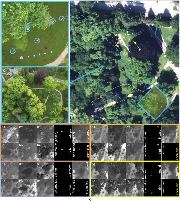
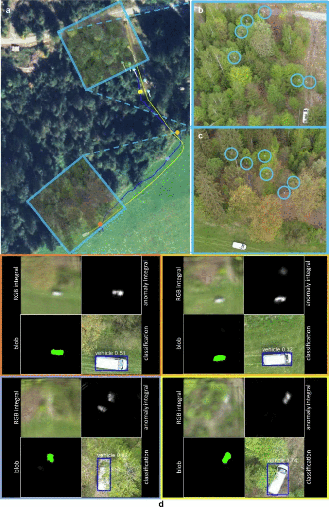
In forestry, swarms can map canopy health, detect early signs of disease or pest infestation, and monitor illegal logging by combining RGB, multispectral, and thermal imaging across many simultaneous flight paths. Wildlife teams can use coordinated drones to track animal movements, locate poaching hotspots, and search for individuals in dense vegetation, where multi-angle synthetic-aperture and anomaly-detection techniques make targets visible even under heavy cover. Because the workload is shared, each drone can fly shorter legs, preserving battery life while still achieving fine spatial and temporal resolution.
During disasters, autonomous swarms can rapidly scan collapsed buildings, flooded regions, or wildfire fronts to find survivors, map damage, and guide first responders along the safest routes. The collective intelligence of the swarm allows it to adapt search patterns as new evidence appears, prioritize high-probability areas, and maintain communication even when some units are lost or blocked by terrain. This combination of speed, redundancy, and flexible coverage makes swarms a powerful civil tool for saving lives and protecting ecosystems in some of the most challenging operating conditions.
Future Trends: Larger, Smarter, Faster Swarms
Future trends point toward an autonomous drone swarm ecosystem that is not only larger in size but also far more intelligent and agile. Rising processing power, better batteries, and high‑bandwidth networks are making it feasible to coordinate dozens or even hundreds of autonomous drone swarm units in a single mission. These advances will allow swarms to cover vast regions quickly, maintain persistent presence, and handle tasks that would overwhelm individual UAVs.
Swarms are also becoming smarter through deeper AI integration. Machine learning models running at the edge will help each autonomous drone swarm learn optimal formations, adapt search patterns, and refine behaviors based on mission feedback rather than only pre‑programmed rules. Techniques like anomaly detection, reinforcement learning, and cooperative planning will enable swarms to detect subtle changes in complex environments—such as shifting wildfire fronts or evolving traffic patterns—and respond in near real time with minimal human supervision.
Speed is the third axis of change: faster airframes, improved sense‑and‑avoid systems, and low‑latency 5G/6G links will let future autonomous drone swarm operations move and re‑task much more rapidly. In agriculture and logistics, this means fleets that can re‑route on the fly based on weather or demand; in emergency response, it means dense coverage of disaster zones within minutes rather than hours. Combined with better regulation, remote ID, and counter‑drone safeguards, these larger, smarter, faster swarms are poised to shift from experimental pilots to a mainstream layer of digital infrastructure supporting cities, industries, and environmental management worldwide.
Conclusion
Autonomous drone swarms are moving from experimental labs into real-world operations, and their trajectory points toward even greater scale, intelligence, and impact. As algorithms for swarm formation, anomaly detection, and cooperative navigation mature, fleets of drones can already detect and track targets in dense vegetation, coordinate complex search patterns, and adapt formations to local conditions in real time. These capabilities demonstrate that swarms are not just a more powerful version of a single drone, but a qualitatively different sensing and decision-making platform.
At the same time, advances in communications, onboard computing, and energy systems are making swarms more practical, resilient, and affordable for civil and industrial users. Mesh networking and edge AI allow each drone to contribute to a shared situational picture while remaining capable of safe, local decision-making if links degrade. This combination of decentralization and coordination means swarms can continue missions despite individual failures, cover larger areas in less time, and provide richer data to human operators. As regulations catch up, this will open new applications in infrastructure inspection, environmental monitoring, logistics, and emergency response, where speed and coverage are critical.