DJI Mavic 3 Enterprise: Advanced Mapping and Inspection Drone
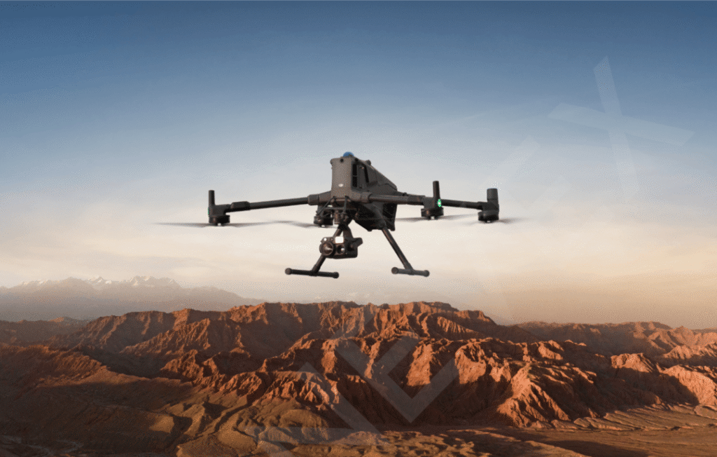
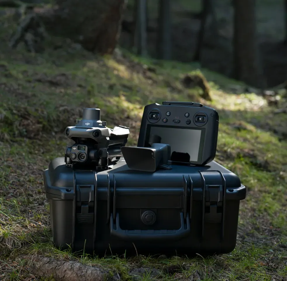
The DJI Mavic 3 Enterprise represents a leap forward in professional drone technology, combining advanced flight performance with powerful imaging tools tailored for industrial, surveying, and public safety missions. With a compact, foldable design and a robust build, the DJI Mavic 3 Enterprise is engineered for portability and rapid field deployment, making it the ideal solution for teams that demand efficiency without sacrificing quality. Its extensive flight time of up to 45 minutes and support for RTK (Real-Time Kinematic) modules ensures high-precision mapping, detailed inspections, and broad area surveys in a single flight—making the DJI Mavic 3 Enterprise invaluable for mission-critical operations.
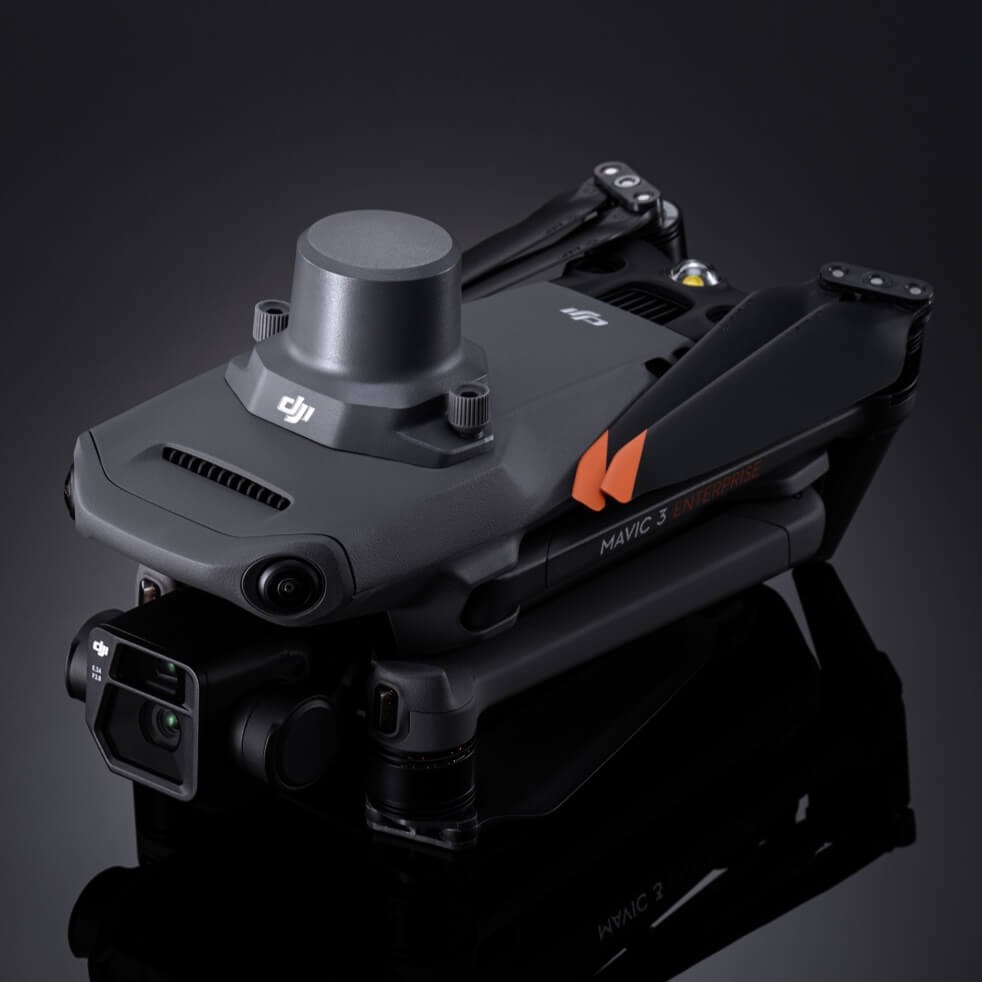
What sets the DJI Mavic 3 Enterprise apart is its state-of-the-art imaging system, featuring a mechanical shutter for distortion-free mapping, a high-resolution 20MP wide camera, and a 56x hybrid zoom for inspecting hard-to-reach areas in superior detail. Enhanced low-light capabilities ensure reliable results even under challenging conditions, while intelligent flight features and obstacle sensing contribute to both pilot safety and mission success. These technological advancements position the DJI Mavic 3 Enterprise as a game-changer for industries seeking reliable drone solutions with professional-grade data capture and operational simplicity.
Overall, the DJI Mavic 3 Enterprise is designed to streamline workflows for industrial inspection, mapping, public safety, and more. Its seamless integration with enterprise software, powerful onboard processing, and advanced transmission range empower organizations to scale their aerial data collection with confidence. Teams can count on the DJI Mavic 3 Enterprise for accurate, actionable insights delivered efficiently while maintaining the highest standards of safety and reliability.
Key Features and Technical Specifications
The DJI Mavic 3 Enterprise stands as a benchmark for small commercial drones, offering a balance of innovative technologies and user-friendly design that addresses the needs of professionals in mapping, surveying, inspection, and public safety. With its compact and portable airframe, the DJI Mavic 3 Enterprise is engineered for rapid field deployment and seamless integration into any workflow. This commercial-grade drone unites mechanical shutter precision, high zoom capability, and RTK support—empowering accurate geospatial data capture in a single, efficient platform. The DJI Mavic 3 Enterprise also bolsters operational safety with omnidirectional obstacle sensing and reliable long-range video transmission, catering to demanding environments and mission-critical applications.
The DJI Mavic 3 Enterprise features a mechanical shutter and 20MP wide camera, delivering precise mapping and distortion-free imaging for enterprise-grade results. Designed for professionals, the DJI Mavic 3 Enterprise stands out in surveying, inspection, and data acquisition, offering high reliability and sharp, true-to-life visuals.
Equipped with 56x hybrid zoom and advanced low-light capabilities, DJI Mavic 3 Enterprise makes inspecting infrastructure and hard-to-reach locations effortless. Its high-res telephoto lens ensures clear visuals even in challenging conditions, making DJI Mavic 3 Enterprise a top choice for detailed, demanding commercial operations.
DJI Mavic 3 Enterprise boasts an impressive flight time of up to 45 minutes, letting users cover broad areas and complete long missions without interruption. The drone’s compact foldable frame enables rapid deployment and easy portability, allowing the DJI Mavic 3 Enterprise to adapt to diverse field scenarios efficiently.
With RTK module support, DJI Mavic 3 Enterprise achieves centimeter-level GPS accuracy for mapping and geospatial tasks. This precision makes DJI Mavic 3 Enterprise the ideal platform for surveyors and engineers needing accurate data for construction, land management, and infrastructure planning.
DJI Mavic 3 Enterprise integrates omnidirectional obstacle sensing and DJI O3 Enterprise transmission, providing robust safety and up to 15 km of stable video link. Operators benefit from real-time 1080p live view and secure, remote command, reinforcing DJI Mavic 3 Enterprise’s reputation for reliability in mission-critical workflows.
Specifications
| Specification | Details |
|---|---|
| Focus Keyword | DJI Mavic 3 Enterprise |
| Camera (Wide) | 20MP 4/3 CMOS sensor, mechanical shutter |
| Camera (Telephoto) | 12MP, 8x (56x hybrid zoom) |
| Video Resolution | 4K: 3840×2160@30fps, FHD: 1920×1080@30fps |
| Max Flight Time | Up to 45 minutes |
| Max Wind Resistance | 12 m/s |
| RTK Module Support | Yes, for centimeter-level mapping |
| GNSS | GPS, Galileo, BeiDou, GLONASS (GLONASS via RTK only) |
| Transmission System | DJI O3 Enterprise, up to 15 km (FCC) |
| Obstacle Sensing | Omnidirectional (forward, backward, lateral, up, down) |
| ISO Range (Wide/Tele) | Wide: 100-6400, Tele: 100-6400 |
| Shutter Speed (Wide) | Electronic: 8-1/8000 s, Mechanical: 8-1/2000 s |
| Thermal Camera (M3T/3TA variants) | 640×512 resolution, 30Hz refresh, multiple color palettes |
| Max Takeoff Altitude | 6000 m above sea level |
| Portability | Foldable design, 915g |
| Storage | Internal 64GB + microSD support |
| Battery Charging | 88W direct, 100W hub, approx. 70-90min |
| Operating Temperature | -10°C to 40°C |
| Photo Format | JPEG/DNG (RAW), R-JPEG (Thermal) |
Industrial Applications: Mapping, Inspection, and Surveying
DJI Mavic 3 Enterprise excels in a range of industrial applications, setting new standards for mapping, inspection, and surveying tasks. With its advanced sensors, mechanical shutter, hybrid zoom, and RTK support, this drone delivers highly accurate, actionable data for professionals in engineering, construction, and geospatial industries. Below are some ways the DJI Mavic 3 Enterprise is applied:
Mapping:
With a mechanical shutter and 20MP camera, DJI Mavic 3 Enterprise produces distortion-free aerial maps suitable for GIS, cadastral, and topographic surveys. RTK module enables centimeter-level accuracy, streamlining workflows for land planners and GIS analysts to update boundaries with speed and precision.Inspection:
The 56x hybrid zoom and robust low-light performance make DJI Mavic 3 Enterprise ideal for close-up inspections of bridges, power lines, wind turbines, and other infrastructure. Engineers can detect wear, faults, and maintenance needs remotely, improving safety and efficiency in asset monitoring.Surveying:
DJI Mavic 3 Enterprise supports rapid elevation and boundary data collection for construction, agricultural, and property surveys. Accurate terrain models and volumetric measurements boost project planning, enabling surveyors to make informed decisions with reliable geospatial data.Agriculture:
Farmers use the drone to map fields, analyze crop health, and optimize planting patterns. The RTK module and multispectral sensor integration help maximize yields and resource allocation through precise, repeatable surveys and remote management.Environmental Monitoring:
Researchers leverage the DJI Mavic 3 Enterprise for habitat mapping, deforestation tracking, and ecosystem analysis. High-precision imaging and geospatial accuracy facilitate informed conservation and regulatory compliance.
Omnidirectional Sensing and Safety Features
DJI Mavic 3 Enterprise sets a high standard for safety and autonomy with its omnidirectional obstacle sensing and advanced safety features. Using multiple wide-angle vision sensors on all sides—forward, backward, lateral, upward, and downward—the drone continuously scans the environment in real time to detect and avoid obstacles from every direction. Supplemented with an infrared sensor on the bottom and powered by an intelligent vision computing engine, DJI Mavic 3 Enterprise precisely plans safe flight routes even in complex or cluttered environments, significantly reducing collision risks and improving operator confidence.
The Advanced Pilot Assistance System (APAS 5.0) enables DJI Mavic 3 Enterprise to smoothly navigate around objects and maintain optimal trajectory, supporting automated return-to-home (RTH) and high-precision hovering. These features work together with the drone’s robust wind resistance (up to 12 m/s) and powerful navigation sensors for reliable performance in a variety of challenging industrial scenarios, including mapping, inspection, and surveying in urban or remote locations.
Beyond its sensing capabilities, the Mavic 3 Enterprise incorporates a comprehensive suite of safety-focused technologies designed to support mission-critical workflows. The integrated AirSense ADS-B receiver improves situational awareness by detecting nearby aircraft, giving pilots timely alerts to maintain safe airspace separation. Meanwhile, the geofencing system and restricted-airspace warnings ensure compliance with aviation guidelines, making operations safer and more predictable.
Additional safety mechanisms, such as built-in beacons, bottom-mounted lights for increased visibility, and intelligent self-discharge batteries, further protect the drone, assets, and people around it. These lighting systems enhance visibility during low-light missions, while smart batteries manage power levels to prevent swelling and degradation over time.
Taken together, these innovations elevate DJI Mavic 3 Enterprise to an industry-leading platform for professionals who need high levels of flight security, operational reliability, and peace of mind. Whether deployed for public safety, infrastructure inspection, environmental monitoring, or precision mapping, the drone’s safety ecosystem ensures stable, predictable performance even during demanding missions—empowering organizations to operate more confidently and efficiently than ever before.
Workflow Integration: Software and Remote Management
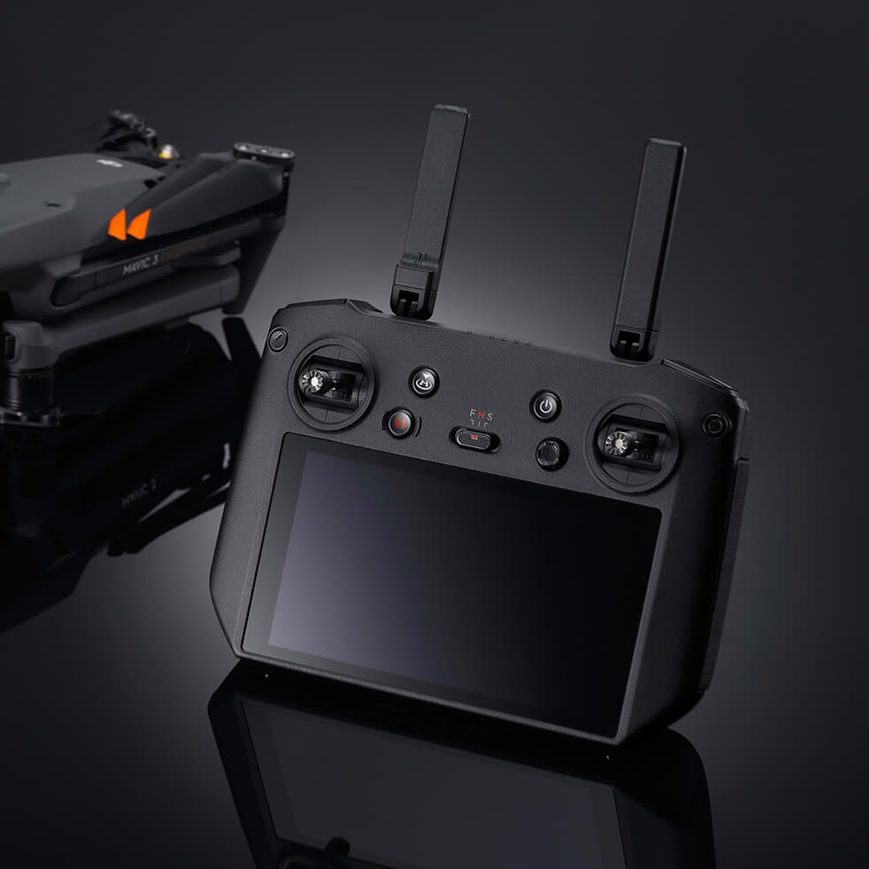
DJI Mavic 3 Enterprise offers powerful workflow integration, marrying advanced hardware features with flexible, streamlined software and remote management tools. At the heart of its workflow integration is the seamless compatibility with DJI Pilot 2 and DJI FlightHub 2, enabling professional users to efficiently plan, execute, and automate flight missions right from their desktop or smart device. These tools allow operators to predefine flight paths, monitor missions in real-time, and synchronize collected geospatial data to cloud platforms for instant collaboration and processing. This combination makes enterprise-level operations scalable, secure, and highly responsive to dynamic project needs.
Further enhancing the end-to-end workflow is the Mavic 3 Enterprise’s native support for third-party photogrammetry and mapping solutions such as DJI Terra, DroneDeploy, and Rock Cloud. Professionals can easily export high-resolution imagery and GNSS datasets for advanced post-processing, 3D modeling, and automated reporting. The integration with RTK correction networks is plug-and-play, allowing surveyors and GIS specialists to connect to custom or standard correction sources for centimeter-level positioning accuracy. Regular firmware updates ensure broad compatibility, continuous improvements, and feature expansion, keeping field operations up to date and secure.
Conclusion
The DJI Mavic 3 Enterprise has established itself as a game-changing solution for professionals in mapping, surveying, inspection, and industrial monitoring. Its integration of a mechanical shutter, 56x hybrid zoom, and RTK module delivers centimeter-level precision and operational versatility, allowing organizations to tackle complex projects efficiently and accurately. The omnidirectional obstacle sensing, long-range connectivity, and adaptable payload options set new standards for safety, reliability, and mission performance in diverse environments.
Beyond hardware, the Mavic 3 Enterprise excels in software integration and workflow management, making fleet oversight, mission planning, and data processing intuitive and scalable. Whether in agriculture, construction, infrastructure, or public safety, its capabilities streamline decision-making and reduce operational costs. With robust thermal, multispectral, and zoom modules, the platform meets not only the needs of today but adapts to the evolving demands of tomorrow.