Rajasthan Drone Survey: Digital Mapping for Smarter Governance
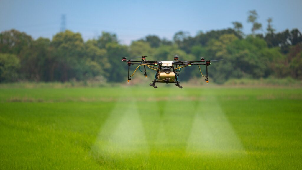
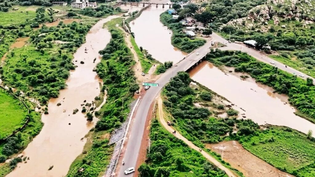
Rajasthan drone survey has emerged as a powerful example of how modern mapping technology can accelerate large infrastructure planning while improving accuracy and transparency. By flying along the proposed 175‑kilometre canal alignment, drones have captured high‑resolution imagery and elevation data for every stretch of land, including hills, rivers, ponds, settlements, and government land. This detailed digital model replaces slow, error‑prone manual surveys and gives planners a precise, up‑to‑date picture of the terrain they need to design through. Rajasthan drone survey thus becomes the foundation for smarter engineering decisions and cost control during such mega water projects.
A major advantage of the Rajasthan drone survey is its impact on land allotment and acquisition workflows. Authorities can now identify exactly which parcels fall in the canal corridor, which stretches will require structural changes, and where alternative routes or design tweaks might reduce social or environmental impact. This helps revenue officials prepare more accurate reports on affected farmers, calculate compensation more fairly, and plan forest‑land diversion with clear digital evidence. For citizens, this level of clarity can reduce disputes, build trust in the process, and speed up approvals that previously stalled large projects for years.
Looking ahead, the Rajasthan drone survey model shows how digital surveying can support long‑term water security and regional development. For the Ramjal Setu Link Project, the canal is expected to bring drinking water first and later irrigation benefits to multiple districts, so a robust geospatial baseline is critical for future maintenance, monitoring, and expansion. Once created, these datasets can support flood risk assessment, road planning, and other infrastructure needs along the corridor. In this way, Rajasthan drone survey is not just a one‑time technical exercise but a strategic investment in data that will continue to guide policy makers, engineers, and communities for decades.
Drone Mapping for the Ramjal Setu Link Canal
Rajasthan drone survey has become the backbone of planning for the Ramjal Setu Link Canal, ensuring every metre of the proposed 175‑kilometre alignment is mapped with high precision. Using high‑resolution cameras and LiDAR, the Rajasthan drone survey team captured detailed data on landforms, hills, rivers, ponds, villages, and government land along the canal corridor. This comprehensive digital model allows engineers to understand terrain challenges, optimise the route, and design structures like aqueducts, tunnels, and crossings with far greater accuracy than traditional ground surveys.
Beyond engineering design, the Rajasthan drone survey is crucial for transparent land management and approvals. Authorities can clearly see which private, agricultural, forest, and government parcels fall within the canal footprint, helping them plan land acquisition, compensation, and forest‑land diversion more fairly. The same datasets will later support construction monitoring, progress verification, and long‑term maintenance of the Ramjal Setu Link Canal, making Rajasthan drone survey a strategic investment that reduces risk, cost, and disputes throughout the project lifecycle.
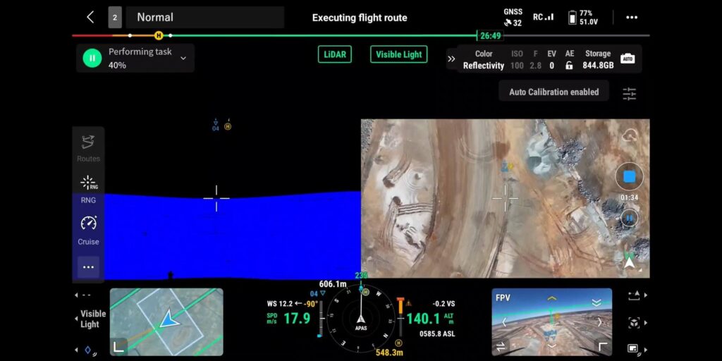
High-Resolution Land and Terrain Data Collection
High-resolution land and terrain mapping sits at the heart of the Rajasthan drone survey, turning raw aerial footage into actionable geospatial intelligence. By flying systematic grids over the proposed canal and surrounding areas, drones capture thousands of overlapping images and elevation points. These datasets are then processed into detailed 2D orthomosaics and 3D terrain models, giving planners an accurate, up-to-date view of every contour, structure, and land parcel along the corridor. Rajasthan drone survey outputs become the single source of truth for engineers, administrators, and policymakers. Rajasthan drone survey also ensures future maintenance and expansion decisions are based on precise ground realities.
High-Detail Orthomosaic Imagery
Rajasthan drone survey generates ultra-clear orthomosaic maps by stitching together hundreds of geo-tagged photos into a single, scale-accurate image. Each pixel represents real ground distance, allowing teams to measure canal widths, offsets, access roads, and nearby infrastructure with survey-grade precision directly on screen.Accurate Digital Elevation Models
Using photogrammetry, the Rajasthan drone survey produces Digital Terrain Models and surface models that capture slopes, embankments, ridges, and low-lying areas. These elevation layers help engineers plan cut-and-fill volumes, design stable canal sections, and anticipate flood or erosion risks before construction begins.Comprehensive Feature Extraction
From one drone dataset, surveyors can digitize roads, buildings, power lines, waterbodies, and property boundaries. This feature extraction from Rajasthan drone survey data streamlines land acquisition planning, utility shifting, and environmental clearances, since all stakeholders work from the same detailed base map.Repeatable Monitoring Over Time
Because flights can be repeated over the same route, Rajasthan drone survey enables time-series analysis. Comparing datasets across months or years reveals construction progress, encroachments, land-use change, and potential problem spots, supporting proactive management throughout the canal’s lifecycle.Seamless Integration with CAD and GIS
High-resolution outputs from Rajasthan drone survey are easily imported into CAD and GIS software used by engineers and planners. This compatibility allows immediate use of terrain and land data in hydraulic modeling, alignment optimization, structural design, and decision dashboards for government authorities.
Benefits for Farmers, Forest Land and Local Communities
Rajasthan drone survey delivers wide-ranging social and environmental benefits by giving decision-makers a clear, data-backed view of how the Ramjal Setu Link Canal will affect people and landscapes. High-resolution maps help authorities design the alignment to minimize displacement, protect sensitive forest patches, and optimise routes for future irrigation networks. When implemented well, this approach turns a complex water project into an inclusive development opportunity rather than a source of conflict. Additionally, the ability to visualize terrain in 3D allows planners to predict soil erosion risks, plan appropriate embankment designs, and identify areas where drainage structures may be required. Such foresight reduces construction errors and cost overruns. By integrating drone data with GIS platforms, authorities can also model long-term hydrological behaviour, ensuring that canal water distribution is equitable and sustainable across multiple districts. This decision support framework strengthens public confidence by showing that development planning is transparent, data-driven, and accountable.
For farmers, drone-derived parcel maps support more accurate identification of affected land, reducing disputes over boundaries and compensation eligibility. Clear digital records enable transparent valuation, faster processing of acquisition cases, and better planning of field channels for eventual irrigation supply. Over time, improved water availability can stabilise yields, support crop diversification, and reduce dependence on erratic rainfall in many Eastern Rajasthan districts. Drones also help create updated land-use datasets that reflect the latest cropping cycles, soil conditions, and micro-irrigation potential, helping the administration plan targeted support schemes. With accurate maps, farmers can access government benefits more easily, as eligibility criteria are verified using reliable geospatial records. As irrigation networks expand, drone data will be vital in planning water allocation schedules, ensuring fairness between upstream and downstream villages. This strengthens rural prosperity and reduces long-standing water conflicts.
Forest land and local communities also gain from the Rajasthan drone survey, as it highlights where the canal intersects reserve areas, common lands, and village infrastructure. This helps planners propose alternative forest parcels for compensatory afforestation and realign segments to reduce ecological fragmentation where feasible. Villages receive better information on canal routing, potential employment during construction, and future access to drinking water, building trust and participation in the project’s long-term success. With detailed environmental mapping, authorities can detect wildlife corridors, identify threatened habitats, and design mitigation structures such as underpasses or green bridges to protect biodiversity. Communities also benefit from improved planning of resettlement sites, ensuring access to schools, roads, and services. By conducting awareness drives supported by drone visuals, project teams can explain construction timelines and safety measures clearly, reducing rumours and resistance. Ultimately, this approach ensures that development remains socially responsible, ecologically sensitive, and grounded in continuous community engagement.
Technical Workflow: From Flight Planning to Digital Maps
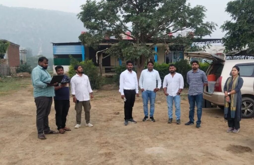
A technical workflow describes how raw aerial data from a Rajasthan drone survey is converted into accurate, usable digital maps that engineers and administrators can trust. Each stage—planning, flying, processing, and validating—adds precision and context. When done systematically, this workflow ensures that every centimetre of terrain and every land parcel along a project like the Ramjal Setu Link Canal is captured, measured, and mapped with survey-grade reliability.
Flight Planning and Mission Design
The workflow begins with defining objectives and drawing the exact corridor or area to be covered. Planners set flight altitude, overlap, ground sampling distance, and safety buffers around villages, roads, and power lines. Well-planned missions in a Rajasthan drone survey minimise gaps, ensure uniform image quality, and reduce the number of re-flights needed later.Ground Control and Coordinate Setup
Survey teams mark and measure Ground Control Points with high-accuracy GNSS equipment. These reference points anchor the imagery to real-world coordinates, which is critical for canal alignment and land ownership work. In a Rajasthan drone survey, robust control networks ensure that maps align perfectly with cadastral records and other government GIS layers.Autonomous Flight and Data Capture
Drones then fly pre-programmed routes, capturing thousands of overlapping photos and, where needed, LiDAR or multispectral data. Operators monitor battery levels, signal strength, and weather but rarely need to intervene. Consistent, high-overlap data capture is what allows Rajasthan drone survey projects to deliver detailed 2D and 3D outputs over very long corridors.Photogrammetry and 3D Reconstruction
Back in the processing lab, software aligns images, performs aerial triangulation, and generates dense point clouds, digital elevation models, and orthomosaics. Noise is filtered out and breaklines or water bodies are carefully modeled. At this stage, the Rajasthan drone survey effectively turns into a virtual replica of the terrain that engineers can measure and design on with confidence.Quality Checks and Map Production
Finally, technicians compare map results against check points and known features, correcting any positional or height errors that exceed tolerance. Once validated, the data is exported into CAD and GIS formats as contours, parcel layers, canal centre lines, and construction drawings. This completes the Rajasthan drone survey workflow, delivering authoritative digital maps ready for design, land acquisition, and long-term asset management.
Governance, Transparency and Faster Decision-Making
Rajasthan’s use of drone-based mapping for the Ramjal Setu Link Project is also reshaping governance, transparency, and the speed of public decision-making. High‑resolution maps of the 175‑kilometre canal corridor give administrators, engineers, and citizens a shared, visual source of truth on terrain, settlements, forests, and government land. This reduces dependence on scattered paper records and subjective site reports, making it easier to justify route choices, cost estimates, and design changes in public forums and official reviews.
For land allotment and acquisition, digital outputs from the drone survey support more transparent and accountable processes. Parcel boundaries, ownership categories, and affected areas can be overlaid directly on the canal alignment, helping revenue officials quantify exactly how much land is needed from each village and farmer. This level of precision enables clearer compensation calculations, better options for land swaps with the forest department, and faster approvals from higher authorities that rely on defensible evidence. When citizens can see their plots on accurate maps, disputes and litigation are less likely, further accelerating timelines.
Conclusion
Rajasthan’s drone survey for the Ramjal Setu Link Project shows how digital mapping can fundamentally upgrade planning, governance, and community outcomes. By creating a high‑resolution digital twin of the 175‑kilometre canal corridor, authorities now have a precise picture of terrain, villages, forest patches, and government land instead of scattered paper maps and rough sketches. This geospatial foundation supports better engineering design, reduces technical risk, and helps ensure that a multi‑crore water project delivers its promised benefits to 17 districts in a structured, phased manner.
The same datasets are transforming land acquisition, compensation, and environmental clearances from opaque processes into more transparent, evidence‑based decisions. Accurate parcel boundaries and terrain models make it easier to identify exactly which holdings are affected, what alternatives exist, and how to balance drinking‑water, irrigation, and ecological needs. For farmers and local communities, that means clearer information, fewer disputes, and faster progress towards reliable water supply under the Ramjal Setu Link Canal. For forest and environmental authorities, drone‑generated maps help plan diversions and mitigation measures with much greater confidence.
Ultimately, the Rajasthan drone survey points to a wider shift in how large public projects are conceived and managed. High‑accuracy aerial data, when combined with accountable governance, enables quicker approvals, better monitoring during construction, and long‑term asset management based on measurable realities rather than assumptions. As Rajasthan continues to invest in such data‑driven approaches, projects like the Ramjal Setu Link Canal can become models for how technology, water security, and public trust come together to support resilient development for millions of people.