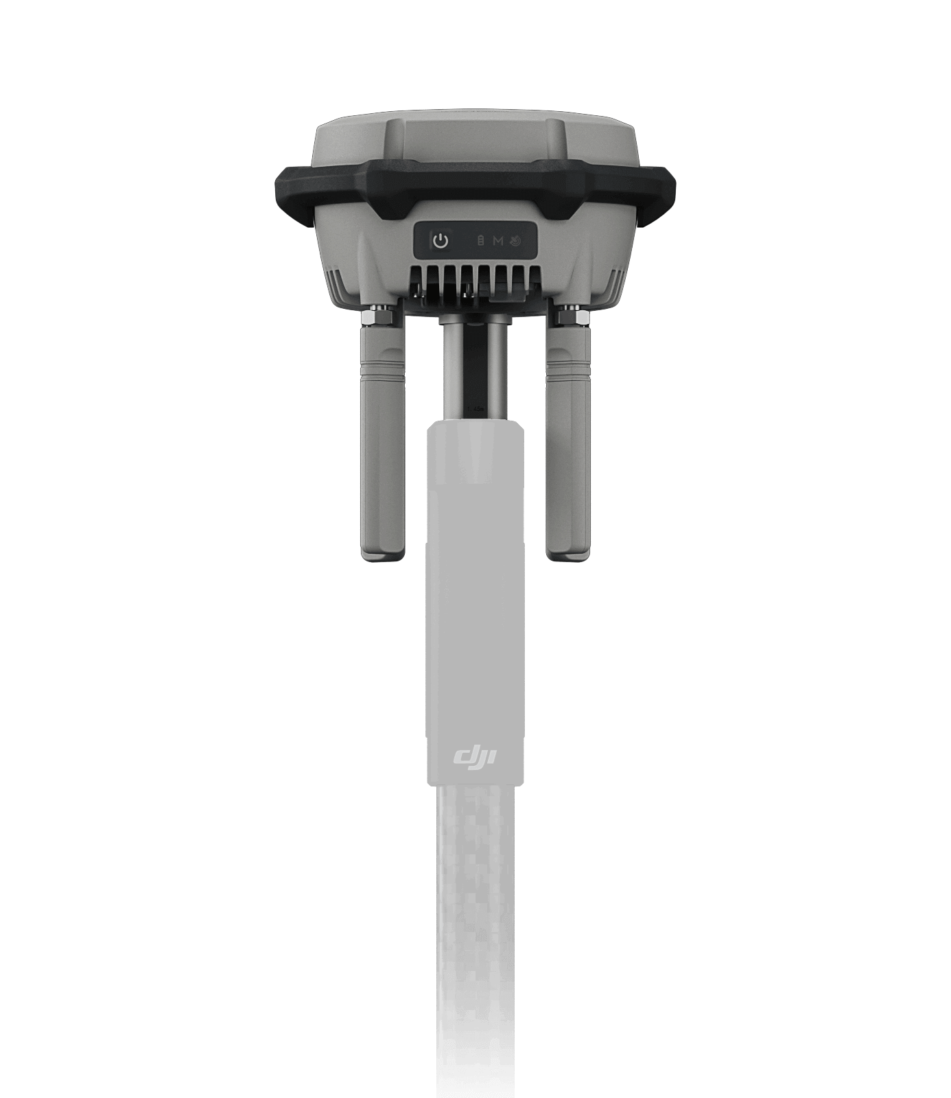
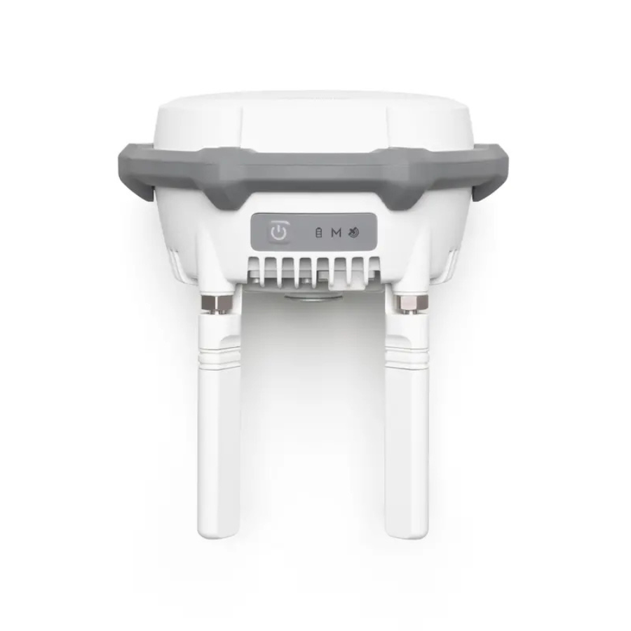
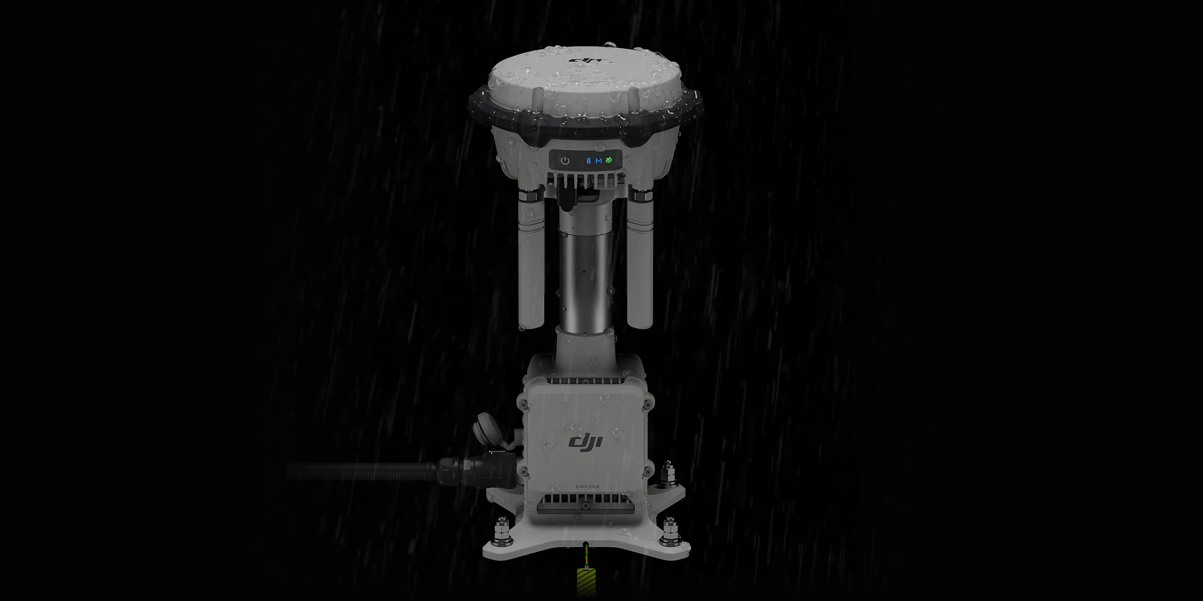
D-RTK 3 Multifunctional Station
Centimeter‑Level Accuracy – Achieves sub-10 cm horizontal precision using PPP or network RTK, with fast convergence times.
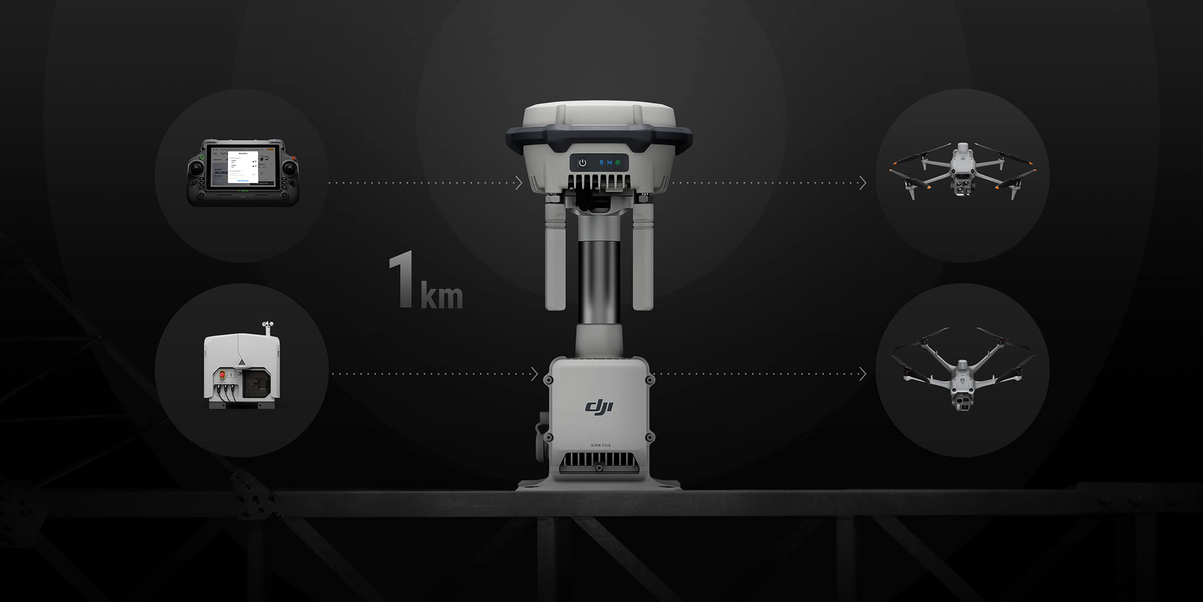
Broadcast Station Mode – Supports multiple drones via O4 long-range video transmission (up to 15 km), ideal for fleet management.
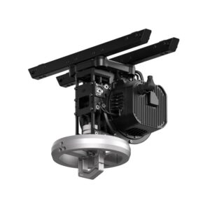
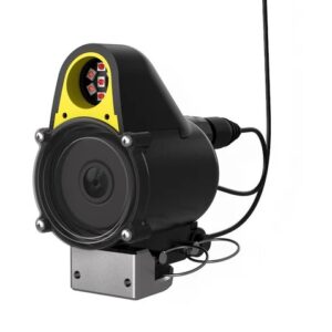
Relay Station Mode – Extends mission range in obstructed environments; works with Matrice 4 series and urban terrain.
Rover Station Mode – Enables GCP capture and tilt compensation for high-precision surveying when used with DJI Enterprise or Terra.
Multi-GNSS, Multi-Frequency – Compatible with major global satellite systems, supporting 19 frequency bands for accurate and robust signal reception.
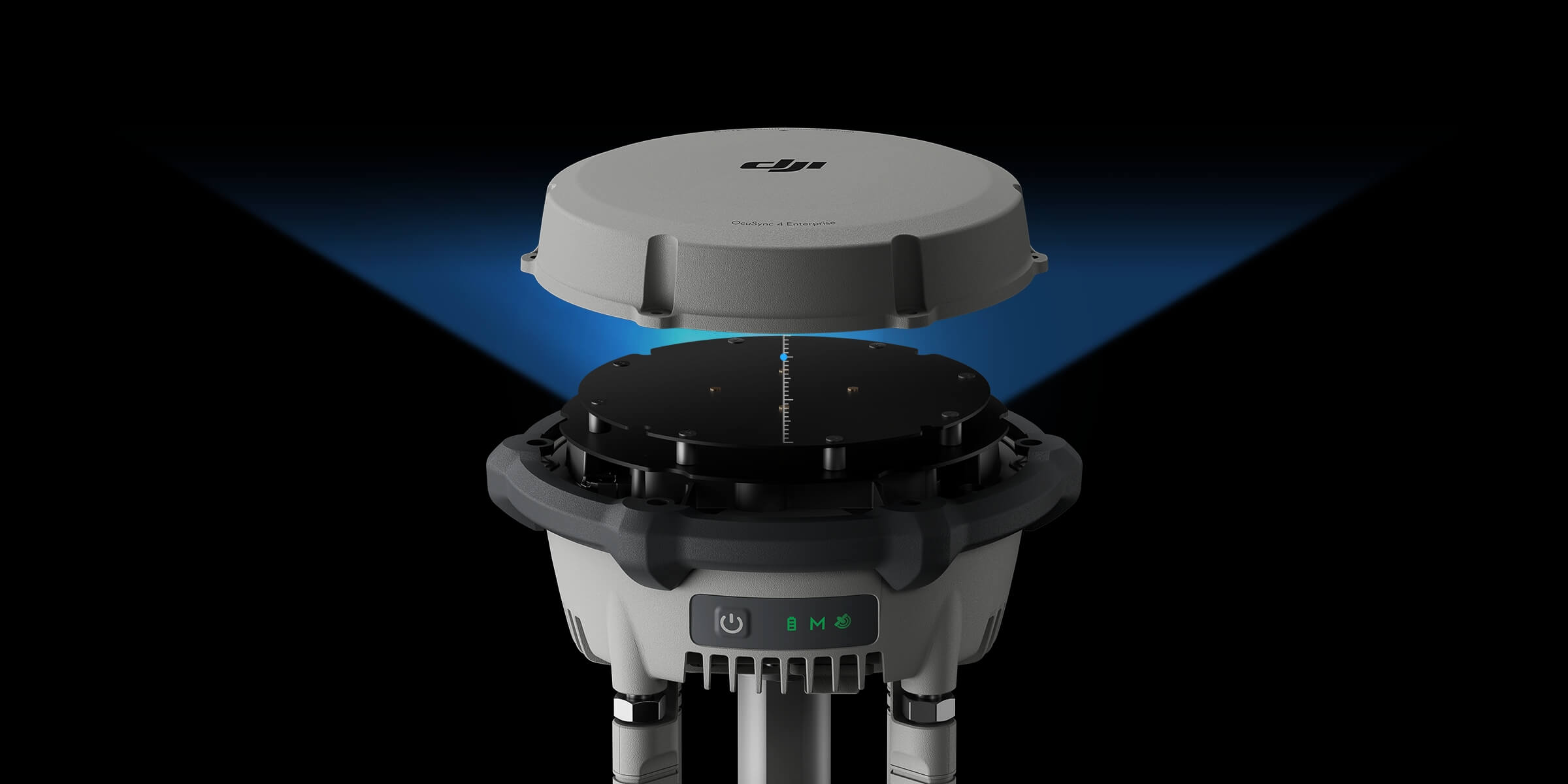
Advanced Antenna & IMU Integration – Features air-dielectric antennas with millimeter-phase-center accuracy and IMU-based orientation analysis.
Flexible Positioning Technology – Offers both standalone PPP decimeter-level accuracy and network RTK centimeter-level precision.
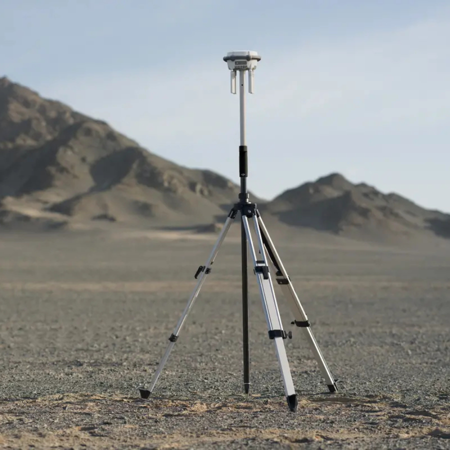
Durable & Portable Design – IP67-rated for dust and water resistance; weighs about 1.26 kg for easy deployment.
USB-C Fast Charging – Charges completely in ~10 hours (Rover), ~7 hours (Base), or ~4 hours (Relay) depending on mode.
Wide Operating Temperature – Functions reliably in challenging environments, supporting a broad temperature range.
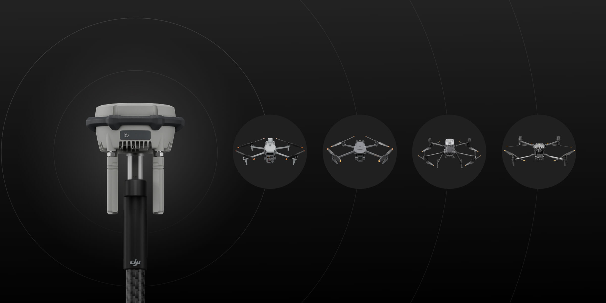
Enterprise-Grade Compatibility – Integrates with DJI enterprise drones and software, including Matrice 4 series, 300/350 RTK, 30 Series, and Mavic 3 Enterprise.
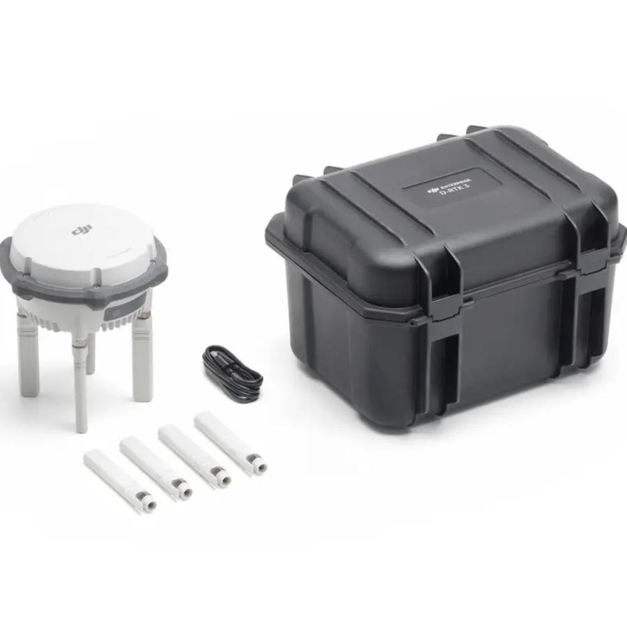
Comprehensive Kit – Includes station body, four directional antennas, and USB-A to USB-C cable.
Features of D-RTK 3 Multifunctional Station
Achieve centimeter-level precision and robust positioning performance with the DJI D-RTK 2 Mobile Station, the ultimate GNSS receiver for commercial drone operations. Built for versatility and accuracy, it ensures your flights are safe, reliable, and repeatable—even in the most complex environments.
- Delivers centimeter-level RTK positioning accuracy, critical for surveying, mapping, inspection, and precision agriculture
- Supports multi-constellation GNSS (GPS, GLONASS, Galileo, BeiDou) for stronger signal reception and improved location stability
- Seamless compatibility with DJI enterprise drones including Matrice 350 RTK, Matrice 300 RTK, Phantom 4 RTK, and others
- Built-in IMU and tilt sensors offer better positioning reliability in areas with limited satellite visibility
- Durable and IP65-rated construction ensures dust and water resistance in rugged field conditions
- Integrated 4G, OcuSync, Wi-Fi, and LAN communication for flexible data transmission and long-range RTK support
- Operates as a base station or rover, making it multifunctional for standalone or networked GNSS operations
- Up to 15 hours of battery life and hot-swappable battery support for uninterrupted field usage
- Easy deployment with lightweight tripod support and quick auto-survey startup functionality
D-RTK 3 Relay Fixed Deployment Version features highly redundant and reliable hardware and software design, significantly reducing maintenance costs. Equipped with lightning surge protection and an IP67 rating, it operates stably in temperatures ranging from -30°C to 50°C. Once deployed, it can continuously perform outdoor operations with minimal intervention.
D-RTK 3 uses an air dielectric antenna with a filtering design, effectively tracking low-elevation satellites. The antenna phase-center accuracy is maintained within millimeter level, ensuring strong resistance to multipath interference and enabling high-precision positioning even in complex environments.
With its built-in receiver module, D-RTK 3 can receive satellite data from five major satellite systems across nineteen frequency points. Compared to network RTK, D-RTK 3 provides more accurate and stable positioning results under ionospheric effects.
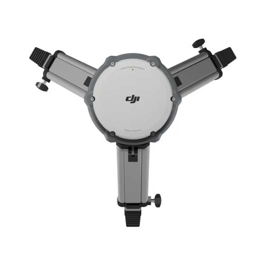
D-RTK 3 supports the new O4 Enterprise video transmission system. Equipped with four external directional antennas, it achieves a maximum RTK coverage range of 15 km [1] in base station mode while ensuring stable signals in all directions. Operators only need to set up one D-RTK 3 Multifunctional Station without additional configuration, allowing multiple drones to connect to the base station and access centimeter-level positioning.
D-RTK 3 Relay Fixed Deployment Version features highly redundant and reliable hardware and software design, significantly reducing maintenance costs. Equipped with lightning surge protection and an IP67 rating, it operates stably in temperatures ranging from -30°C to 50°C. Once deployed, it can continuously perform outdoor operations with minimal intervention.
Adaptable to Various Environments
The Fixed Deployment Version offers outdoor maintenance-free operation and adaptability to various environments. It can be installed on towers, utility poles, parapet walls, and other vertical structures, meeting diverse scenario requirements. Additionally, it supports power supply from DJI Dock 3 or third-party external PoE sources, enabling long-distance deployments.
Standalone Precise Point Positioning (PPP)
D-RTK 3 utilizes DJI’s proprietary PPP solution, enabling satellite-based auto convergence*. It provides free decimeter-level positioning even in challenging network conditions.
Network High-Precision Calibration
D-RTK 3 can receive RTCM data and automatically obtain coordinates and correct positions through the network. When used outdoors, it can achieve centimeter-level precision positioning without pre-measuring the setup point location.
Specifications
General
General Specifications
| Feature | Specification |
|---|---|
| Weight | Approx. 1.26 kg |
| Dimensions | 163 × 89 mm (without antennas) |
| Protection Rating | IP67 (station only) |
| Operating Temperature | −20 °C to 55 °C |
| Altitude Limit | Max 6000 m |
| Power Source / Battery | Internal 6500 mAh, 46.8 Wh |
| Power Consumption | 7 W (Base), 14.5 W (Relay), 6.2 W (Rover); up to 36.5 W USB‑C PD |
GNSS & Positioning
| Feature | Specification |
|---|---|
| GNSS Support | GPS, BDS, Galileo, GLONASS, QZSS, L‑Band (multiple frequencies) |
| Base Station Accuracy | Single point: H 1.5 m / V 3 m; Network RTK: H 1 cm + 1 ppm, V 3 cm + 1 ppm |
| PPP Accuracy | ~20 min convergence; H 0.30 m / V 0.40 m |
| Rover Station Survey (Static) | H 0.8 cm + 1 ppm; V 1.5 cm + 1 ppm |
| Tilt Survey | ≤60° tilt; H ≤ 8 mm + 0.7 mm/° |
| Reliability | > 99.9 % |
Operating Modes & Transmission
| Feature | Specification |
|---|---|
| Modes Supported | Base Station, Relay Station, Rover Station |
| Video Transmission | O4 Enterprise via OcuSync (2.4/5.2/5.8 GHz) |
| Relay Station Range | FCC: 25 km (aircraft‑relay), 1 km (relay‑RC); SRRC: 12 km/1 km; CE: 10 km/300 m |
| Base Station Range | FCC: 15 km; SRRC: 12 km; CE/JP: 8 km |
| Rover Station Range | Bluetooth ~30 m |
FAQs
1. What is the D‑RTK 3 Multifunctional Station?
It’s a rugged, portable GNSS station that functions in three modes:
- Base Station: delivers centimeter-level positioning for multiple drones simultaneously
- Relay Station: extends drone transmission range up to ~15 km in clear conditions
- Rover Station: acts as a mobile survey tool for high-precision control points and mapping
2. What type of battery does it include?
It uses a li‑po battery rated at 6,500 mAh / 46.8 Wh. Estimated run times under normal conditions:
- Relay mode: ~4 hours
- Base mode: ~7 hours
- Rover mode: ~10 hours
3. What are its physical specs and durability rating?
It weighs approximately 1.26 kg, with compact dimensions of 163 × 89 mm (excluding antennas).
The station has IP67-rated protection and can withstand drops from up to 2 meters when mounted on a pole
4. Which environments is it designed for?
Operating temperature ranges from –20 °C to 55 °C, allowing use in alpine, desert, or humid conditions. Maximum supported altitude is 6,000 meters above sea level
5. How is the station powered and charged?
It charges via a USB‑C port using a Power Delivery (PD 3.0) adapter between 9–15 V (e.g. DJI 65 W charger). Charging with a 5 V adapter requires the station to be powered off first. In Relay mode powered via PoE, a backup battery provides about 2 hours runtime
6. What GNSS systems and accuracy does it support?
It supports major satellite systems including GPS, GLONASS, BDS, Galileo, QZSS, and even L‑Band signals. Positioning accuracy reaches approximately 0.8 cm horizontal and 1.5 cm vertical, with tilt compensation accuracy better than 2 cm within 30° tilt in Rover mode
7. How do I check battery level and RTK status?
You can monitor battery and satellite info via:
- On-device indicator lights
- RTK settings menu in Broadcast Mode (on the aircraft)
- DJI Enterprise app in Relay or Rover modes
8. How do I switch between modes?
To change modes:
- Press the power button three times
- Or connect via USB‑C to a remote controller and use the DJI Pilot 2 app
- Or switch modes using DJI Assistant 2 on a PC/Mac
9. Is Relay Station Mode allowed everywhere?
Not always. Relay Mode requires 5 GHz bandwidth support, which is not available in some regions like Japan, Russia, and Kazakhstan. In such areas, only Base and Rover modes work properly
10. Which DJI drones is it compatible with?
It supports a broad range including:
- Matrice 300/350 RTK
- Matrice 30 Series
- Matrice 4 Series
- Inspire 3, Mavic 3 Enterprise, and other Enterprise platforms.
Check DJI’s compatibility list and manual for details on supported modes and devices


Reviews
There are no reviews yet.