Wildlife Drone Research: Revolutionizing Conservation Science
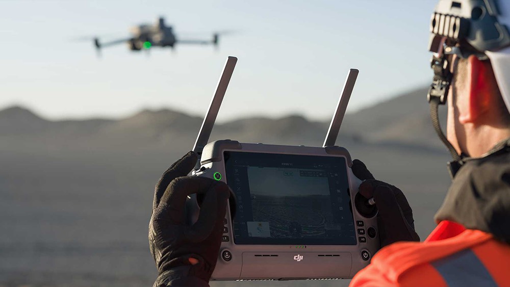
Wildlife drone research is rapidly transforming the way scientists and conservationists study and protect animals in their natural habitats. By leveraging aerial technology, drones provide access to remote and hard-to-reach areas, enabling researchers to survey landscapes, monitor migration routes, and count populations with unprecedented accuracy. The use of drones reduces human disturbance, allowing observation of elusive and shy species such as dugongs and nocturnal wildlife, which might otherwise evade traditional study methods. Wildlife drone research not only speeds up data collection but also ensures safer working conditions by minimizing the need for field teams to traverse treacherous terrain.
A major advantage of wildlife drone research lies in the integration of advanced sensors and AI-powered analytics. Drones equipped with thermal imaging, infrared cameras, and GPS can conduct habitat mapping, monitor breeding patterns, and track individual animals with precision. Automated image analysis powered by artificial intelligence streamlines large dataset processing, helping scientists accurately estimate population sizes and health conditions. Such technologies enable non-invasive research approaches, ensuring more authentic behavioral data while contributing critical insights towards conservation strategies for endangered and threatened species.
The impact of wildlife drone research is evident across multiple conservation initiatives worldwide. From monitoring manatee populations in Florida’s coastal waters to mapping wolf habitats in Minnesota, drones have become indispensable tools for habitat assessments and environmental monitoring. These innovations support adaptive management, improve ecosystem understanding, and inform targeted conservation interventions. As technology advances, wildlife drone research is set to unlock new possibilities, driving sustainable management and preservation efforts for vulnerable wildlife and their habitats across the globe.
Key Drone Technologies for Wildlife Monitoring
Wildlife drone research is revolutionizing field studies by bringing a suite of advanced technologies into biodiversity monitoring and conservation. These tools allow scientists to efficiently survey inaccessible areas, monitor animal populations, and capture detailed ecological data while minimizing disturbance. The integration of AI and high-tech sensors has transformed how researchers track migration, assess health, and map habitats, making wildlife drone research indispensable in modern conservation efforts.
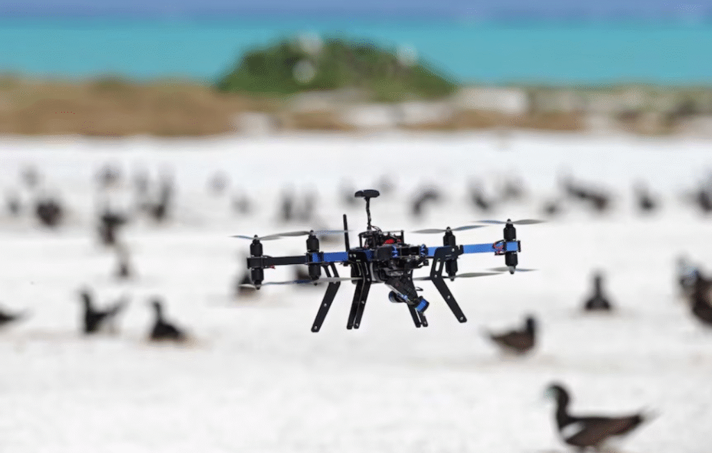
High-Resolution Cameras: Wildlife drone research often utilizes drones equipped with high-resolution visual and infrared cameras to gather images and video of animals in diverse and remote environments. These visuals help estimate population sizes, record behavioral patterns, and monitor elusive or nocturnal species without direct human interference.
Thermal Imaging Sensors: For tracking nocturnal or camouflaged species, wildlife drone research employs thermal imaging sensors that detect heat signatures in dense vegetation or during nighttime surveys. These sensors provide accurate counts, reveal movement patterns, and enhance safety by detecting animals in environments where visibility is low.
GPS and Remote Sensing: Integrating GPS systems and satellite connectivity into drone platforms enables wildlife drone research to chart precise migration routes, habitat use, and landscape changes. Remote sensing supports comprehensive mapping for conservation planning and ecosystem health assessments.
AI-Powered Analytics: Artificial intelligence algorithms in wildlife drone research automate image analysis, classification, and data interpretation, making large-scale wildlife surveys more efficient. AI helps identify species, monitor health indicators, and streamline the evaluation of complex, multidisciplinary datasets.
Radio Telemetry Integration: By pairing drones with radio telemetry receivers, wildlife drone research achieves real-time tracking of collared or tagged animals, even in rugged or hard-to-access areas. This technology supports targeted monitoring, reduces field labor, and provides critical movement data for conservation decisions.
The Impact of Wildlife Drone Research on Modern Ecology
Wildlife drone research is profoundly shaping modern ecology by enabling data-driven insights and revolutionizing field methodologies. Drones have made it possible to study large, inaccessible areas with minimal disturbance to wildlife, providing researchers with high-frequency, precise data and aerial perspectives once difficult or impossible to acquire. This technology empowers scientists to track species migrations, observe behavioral patterns, and monitor ecosystem health, improving ecological assessments across diverse habitats.
One significant impact of wildlife drone research on ecology is the enhanced ability to conduct non-invasive population surveys and habitat mapping. Drones equipped with thermal, visual, and multispectral sensors gather detailed imagery and environmental data without the need for disruptive human presence. This allows for more accurate counts of endangered species, better protection strategies, and real-time monitoring of changes in land use, vegetation, and water resources critical for ecological balance.
Benefits and Efficiency of Drone-Based Surveys
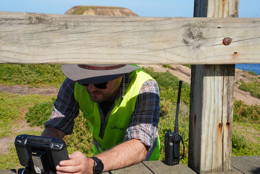
Drone-based surveys offer remarkable benefits and efficiency for wildlife research and conservation. They provide access to remote or dangerous areas without human risk, allowing scientists to monitor habitats and animal populations with greater safety and frequency. Thanks to aerial perspectives and advanced imaging, these surveys cover large landscapes quickly, often within hours compared to days of manual fieldwork.
The high-resolution cameras, thermal sensors, and GPS tracking featured in drone platforms enable precise data collection, delivering accurate population counts and habitat assessments. Automated flight paths and image analysis powered by AI further streamline the process, reducing human error and minimizing survey costs. These efficiencies enable conservation teams to allocate resources more effectively and respond rapidly to environmental changes or wildlife threats.
In addition, drone-based surveys minimize disturbance to wildlife, as drones can observe natural behaviors without encroaching on animals’ territory. This non-invasive approach leads to more authentic ecological data and supports long-term monitoring projects. The combination of accuracy, cost reduction, and ethical research practice has positioned drone-based surveys as a vital tool in modern conservation and ecological science.
Expanding on these advantages, drones also allow researchers to study species that are otherwise difficult to track, such as nocturnal animals or those living in dense forests or rugged terrains. Thermal imaging can detect animals hidden beneath canopy cover or active during low-light conditions, enabling more comprehensive biodiversity assessments. Furthermore, drones can be deployed rapidly following natural disasters like floods, wildfires, or storms to evaluate habitat damage and identify animals in distress—an essential capability for emergency conservation response.
Long-term ecological projects also benefit greatly from drone-based monitoring, as consistent, repeatable flight paths ensure comparable datasets over months or years. This consistency helps detect subtle changes in vegetation, migration patterns, or population movements that might otherwise go unnoticed. As drone technology continues to evolve—with better endurance, improved sensors, and enhanced AI-driven analytics—its role in wildlife conservation is expected to grow even more impactful, empowering organizations to make data-driven decisions that protect ecosystems more effectively.
Challenges and Limitations in Wildlife Drone Research

Wildlife drone research, while transformative, faces several notable challenges and limitations. Technical issues such as limited battery life, flight range, and weather sensitivity can restrict survey coverage and operational hours, especially in remote or harsh environments. Navigating densely forested areas, mountainous terrains, or rapidly changing weather requires careful planning and may sometimes result in data gaps or compromised image quality.
Regulatory and ethical considerations are also significant obstacles. Researchers must comply with airspace regulations and wildlife protection laws, which vary regionally and may prevent drone operations near sensitive habitats or endangered species. Additionally, concerns about privacy, animal disturbance, and potential stress caused by the noise or presence of drones highlight the need for responsible usage and careful protocol design.
Ethical Considerations and Responsible Use
Ethical considerations play a vital role in wildlife drone research, ensuring that technological advancements do not negatively impact animals or their habitats. One major concern is minimizing disturbance to wildlife, as drones may inadvertently stress or displace sensitive species due to their sound and presence. Researchers must design flight protocols that avoid critical breeding times and sensitive locations, reducing the risk of harm while maintaining data collection integrity.
Privacy and responsible data use are also crucial issues. Wildlife drone research often collects imagery and geographic data, so safeguarding information about rare or endangered species—especially in regions prone to poaching—is essential. Adhering to ethical guidelines set by conservation authorities and complying with data protection regulations helps promote trust and protect vulnerable populations.
Additionally, responsible use means full compliance with airspace laws and respect for local communities. Engaging with stakeholders, seeking permits, and being transparent about research goals foster cooperation and legitimacy. Ethical wildlife drone research ultimately balances scientific advancement with animal welfare, community interests, and long-term conservation success.
Expanding further, another key ethical aspect is ensuring that the introduction of drone technology does not replace or undermine traditional ecological knowledge. Many indigenous and local communities have long-standing relationships with their environment, and researchers must value and integrate this knowledge rather than overshadow it. Collaborative approaches that involve community members in survey planning or interpretation can strengthen cultural respect and lead to more meaningful conservation outcomes.

Future Trends: Innovations Shaping Wildlife Research
Future trends in wildlife research signal a new era of tech-driven conservation, where data, automation, and advanced analytics enable faster, more accurate, and more ethical study of ecosystems. Innovations in artificial intelligence, remote sensing, unmanned aerial vehicles, and smart sensors are building collaborative platforms for global ecological monitoring, helping conservationists predict, protect, and respond to threats more efficiently. These future-focused technologies elevate wildlife research to unprecedented levels of scale, precision, and impact.
AI-Powered Habitat and Species Monitoring: Artificial intelligence is set to revolutionize wildlife research by automating species identification from millions of images and predicting ecological changes using integrated drone, satellite, and sensor data. Computer vision and machine learning deliver real-time species tracking and habitat mapping, enabling proactive conservation actions.
Autonomous Drones and Robotics: Next-generation robotics, including autonomous drones, can perform continuous, non-intrusive monitoring of animal behavior and population movements. Equipped with intelligent path-planning, these “ConservationBots” can explore rugged terrain and hard-to-access habitats, supporting anti-poaching and restoration initiatives.
Advanced Remote Sensing Technologies: Innovations in satellite radar, multispectral imaging, and thermal sensors make it possible to capture detailed ecosystem data on land use, vegetation, and animal distributions from space and air. This enables large-scale habitat assessment and immediate detection of changes or threats to biodiversity.
Blockchain for Conservation Data Integrity: Blockchain technology is emerging as a tool for traceability in wildlife product supply chains, ensuring transparent and secure verification of conservation activities. This decentralized ledger can support anti-poaching efforts and enhance trust in the allocation of conservation resources.
Real-Time Data Platforms and Analytics: Integrated platforms collate movement, environmental, and social data for instant visualization, predictive analytics, and collaborative decision-making. These innovations empower multi-stakeholder conservation teams to intervene swiftly and tailor solutions for long-term ecosystem health.
Conclusion: Advancing Conservation with Drone Technology
Drone technology has become a cornerstone in the advancement of wildlife conservation, radically altering how scientists and conservationists approach habitat monitoring, species protection, and ecosystem management. Equipped with high-resolution cameras, thermal sensors, and artificial intelligence algorithms, drones provide an unprecedented ability to access and survey remote or hazardous areas. This capability not only improves the precision and scale of data collection but also enhances safety by reducing risks to researchers who previously had to navigate difficult terrain. The non-intrusive nature of drones allows for frequent, accurate species counts and behavioral observation with minimal disturbance to wildlife and their environments.
One of the most transformative impacts of drone technology in conservation is its support for anti-poaching operations and habitat protection. Drones with night-vision and infrared imaging enable real-time surveillance of vast landscapes, making it possible to detect illegal activities and respond rapidly to threats such as poaching, encroachment, or habitat loss. Combined with AI-supported image analysis, drones can distinguish between animal and human movement, send alerts to ranger teams, and guide responsive interventions before harm occurs. Furthermore, drones generate detailed 3D maps of forests, grasslands, and wetlands, helping conservationists track environmental changes and inform targeted management strategies, from reforestation projects to water resource allocation.
Looking ahead, the fusion of drones, AI, and emerging digital platforms promises to further elevate conservation outcomes. Predictive analytics, blockchain data integrity, and global collaboration open opportunities for more proactive interventions, community engagement, and transparent resource management. Education initiatives and participatory approaches will also enable local communities to become stewards of technological conservation. As drone capabilities expand and integrate with other smart technologies, the conservation sector can move from reactive to predictive ecosystem management, ensuring biodiversity protection and sustainability for future generations.